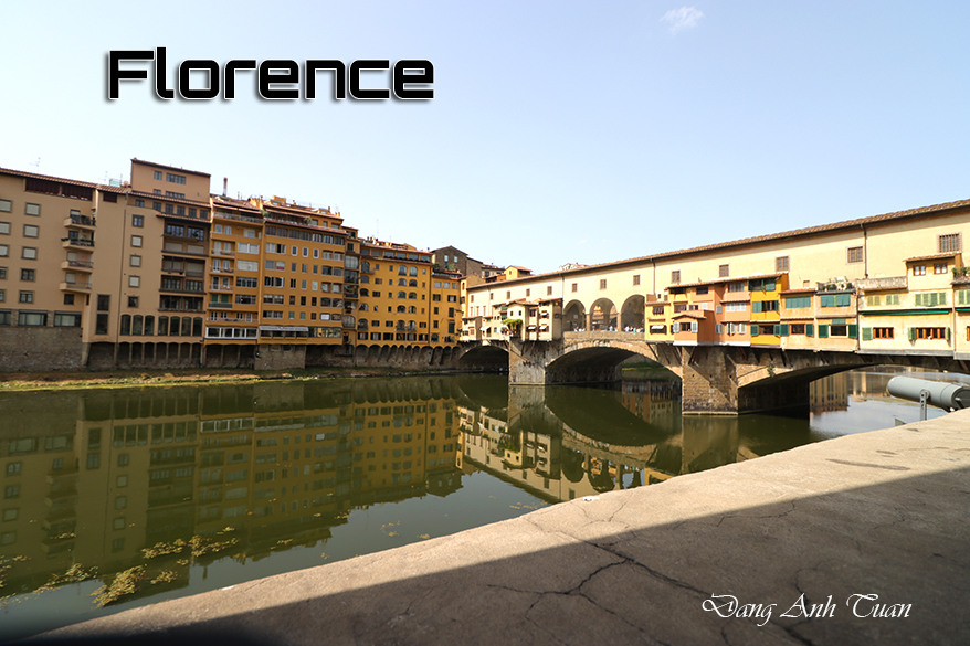
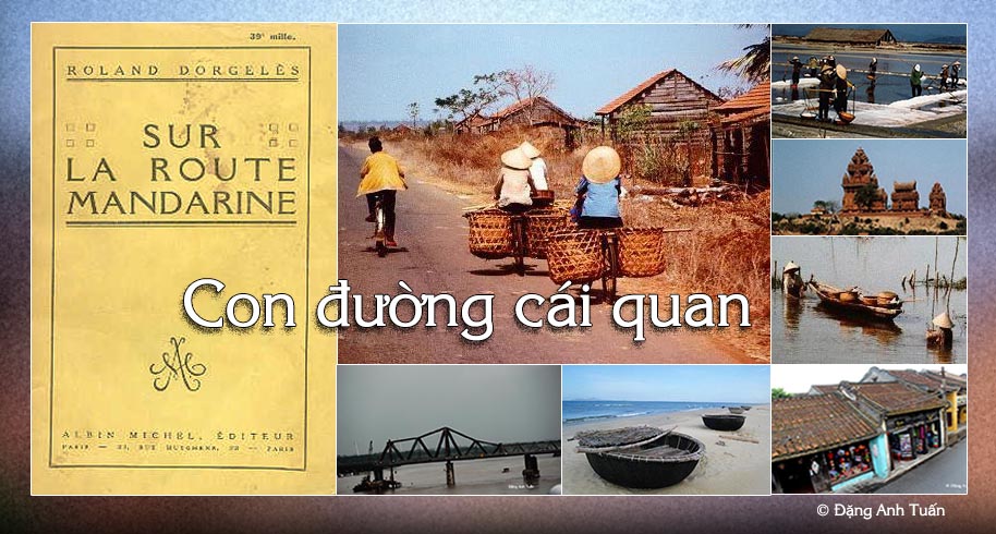
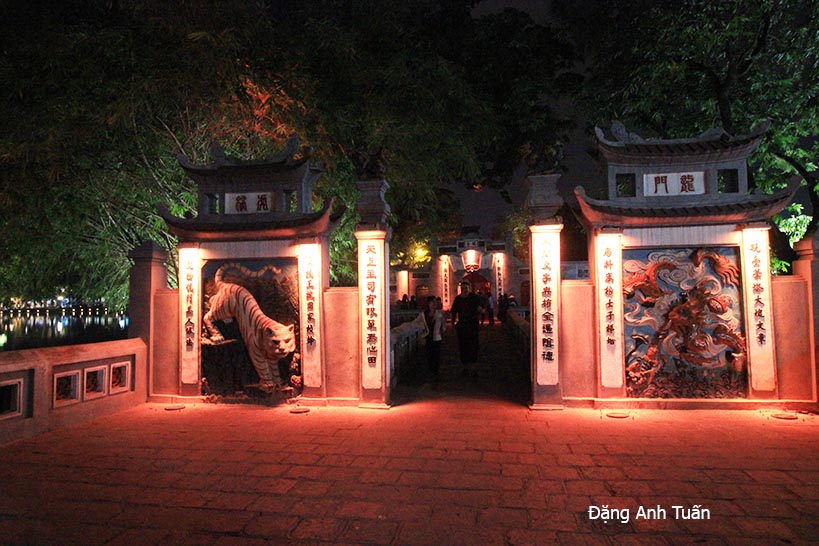
Route mandarine (Version française)


Version française

English version

Con đường cái Quan

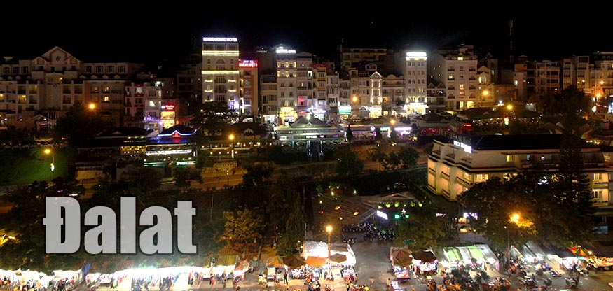
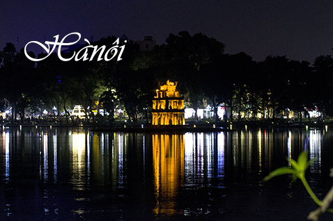
Nếu du khách có cơ hội đi từ Sài Gòn đến Hà Nội bằng ô tô thì bắt buộc phải đi « con đường cái quan » (hoặc Quốc Lộ số 1) vì đây là tuyến đường duy nhất ở Việt Nam. Tên này có tên là « con đường của các quan » mà người Pháp gọi nó như vậy  bởi vì đây là tuyến đường trước đó được các quan lại và các quan chức cao cấp dùng để đi nhanh chóng dễ dàng giữa thủ đô và các tỉnh. Con đường này được sinh ra ở vùng đầm lầy của đồng bằng sông Cửu Long, đầy dãy các muỗi truyền nhiễm. Nó được bắt đầu ở  Cà Mau và kết thúc tại đồn Đồng Đăng ở biên giới Trung-Việt gần vùng Lạng Sơn. Nó thường được xem là cột sống của đất nước trông nhìn như hồi hải mã (cá ngựa). Con đường này dài đến 1.730 cây số, nối liền một số thành phố, đặc biệt là Cà Mau, Bạc Liêu, Cần Thơ, Vĩnh Long, Sài Gòn (hay thành phố Hồ Chí Minh), Phan Thiết, Nha Trang, Quy Nhơn, Hội An, Đà Nẵng, Huế, Đồng Hới, Hà Tĩnh, Thanh Hóa, Ninh Bình, Hà Nội, Lạng Sơn.

Con đường nầy thường được trán nhựa nhưng trải nhựa rất kém thường bị tắc nghẽn trên vài đoạn đường với một số xe vận tải, xe đạp, các người đi bộ,  các đàn trâu, bò và các đàn vịt chạy lon ton. Nhựa đường hay thường bị nổ vỡ, làm cho bà cụ giật mình gác hai chân trên giá hành lý và những đứa trẻ ngồi trên những chiếc xe đạp quá lớn. Đây là những cảnh tượng bất thường hay gặp trên tuyến đường này.

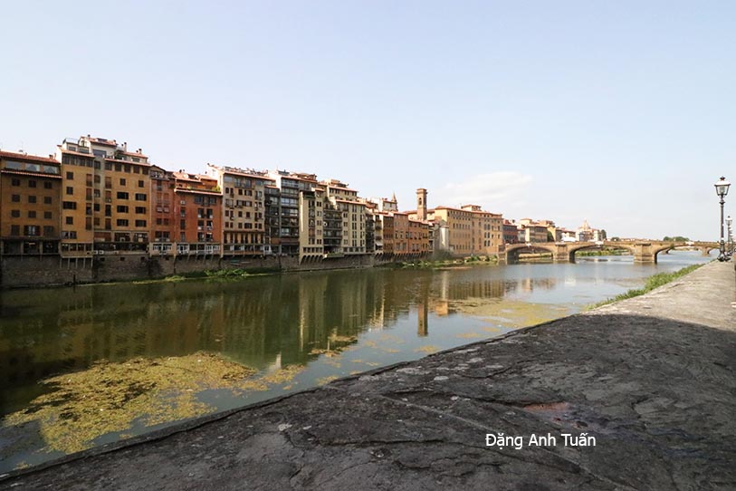
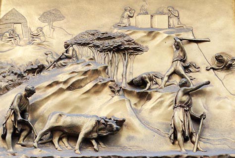
Ngoài ra còn có những mớ lúa hoặc sắn thu thập còn đang phơi khô trên các đường nhựa nung dưới ánh mặt trời ở miền Bắc. Trên con đường này, chúng ta  có thể nhìn thấy ở phía Sa Huỳnh, các đầm lầy muối hoặc những ụ muối phủ đầy một lớp lá và  được dựng theo dọc đường. Càng đi xa về phía bắc, chúng ta càng có được những quan cảnh  yên bình của những cánh đồng lúa ngập nước. Chúng ta thường bắt gặp những đứa trẻ dẫn đầu đàn trâu dính bùn. Ở ngoại ô Hoa Lư, cố đô của Việt Nam, các hình bóng của những ngọn đồi núi đá vôi xuất hiện trong sương mù.Mặc dù tình trạng đường xá rất tồi tệ nhất là ở miền Bắc Việt Nam, nó vẫn tiếp tục là trục đường quan trọng của Việt Nam. Đối với những người thích tìm hiểu về lịch sử Việt Nam, lịch sữ của cuộc Nam tiến, chúng ta  cần nên đi theo con đường này bởi vì chúng ta không chỉ thấy  các di tích của một nền văn minh bị biến mất trong cơn lốc lịch sử, vương quốc Champa mà  còn cả dấu ấn và dấu vết của  những người định cư Việt Nam qua nhiều thập kỷ mà họ  cố gắng áp đặt trong suốt thời gian họ đi qua. Biết con đường này là không chỉ biết đến những cánh đồng lúa mênh mông, những đồn điền cao su, những góc nhìn tuyệt đẹp dọc theo bờ biển Việt Nam, những toàn cảnh tuyệt vời từ đồng bằng này sang đồng bằng khác, các đèo vô cùng ngoạn mục  đặc biệt là đèo Hải Vân, những ngọn đồi rừng rậm, những cánh đồng gần như hoang vắng nhưng cũng có  một sức mạnh của đời sống nông nghiệp Việt Nam thông qua các ấp dọc theo con đường.

 Biết con đường này là cũng biết đến cầu Hiền Lương. Cầu này do người Pháp xây dựng vào năm 1950, bị không quân Mỹ phá hủy năm 1967, dài được 178 mét, chắc chắn gợi lại một thời mà đất nước còn bị chia đôi với một nửa cầu được sơn màu đỏ và nửa còn lại màu vàng. Nó nằm ở trên vĩ tuyến 17, trong một khu vực có một đoạn đường  được biết đến trong thời kỳ chiến tranh Đông Dương dưới cái tên « Đường không vui » vì quân đội Pháp gặp sự kháng cự quyết liệt ở nơi nầy. Biết tuyến đường này là biết đèo Hải Vân. Nó nằm 28  cây số về phía bắc của Đà Nẵng (hoặc Tourane) và chỉ có 496 thước so với mực nước biển. Cũng như tên gọi của nó, nó luôn ở trong mây vì nó rất gần biển, khiến nó  lúc nào cũng nhận được một khối lượng lớn không khí ẩm thấp. Thưở xưa, nó đánh dấu biên giới giữa Bắc và Nam mà còn bảo vệ người Chămpa trước dục vọng xâm chiếm lãnh thổ của người dân Việt. Cố nhạc sỹ Phạm Duy có gợi  đến con đường này qua tác phẩm được mang tên « Con Đường Cái Quan ». 

Route mandarine

Si le touriste a l’occasion de voyager de Saïgon à Hanoï en voiture, il est obligé de prendre la « route mandarine » (ou la route No 1) car c’est la seule qui existe sur le réseau routier du Vietnam. Ce nom « route mandarine », on le doit aux Français qui l’ont appelé car c’était la route prise autrefois par les mandarins et les hauts fonctionnaires pour voyager rapidement et aisément entre la capitale et leurs provinces. Cette route est née dans les marécages du delta du Mékong,  infestés de moustiques. Elle commence à Cà Mau et se termine au poste de Ðồng Ðan de la frontière sino-vietnamienne dans la région proche de Lạng Sơn.  On dit souvent qu’elle est la colonne vertébrale du pays au « look » d’hippocampe. Cette route est longue de 1730 km, reliant plusieurs villes, en particulier Cà Mau, Bạc Liêu, Cần Thơ, Vĩnh Long, Saïgon, Phan Thiết, Nha Trang, Qui Nhơn, Hội An, Ðà Nẵng, Huế, Ðồng Hới, Hà Tịnh, Thanh Hóa et Hanoï.

Elle est recouverte d’une manière générale d’asphalte, mais mal bitumée et encombrée souvent sur certains tronçons d’une multitude de camions, de vélos, de piétons, de buffles et de vaches et de troupeaux de canards qui trottinent. Le bitume explose souvent, faisant tressauter la mamie grimpée en amazone sur un porte-bagages et les mômes juchés sur des vélos trop grands. Ce sont des scènes insolites rencontrées fréquemment sur cette route.

On trouve aussi des récoltes de riz ou de manioc mises à sécher sur l’asphalte chauffée de soleil dans le Nord. Sur cette route, on peut voir du côté de Sa Huynh, des marais salants ou des monticules de sel recouverts de feuillage et dressés le long de la chaussée.

Plus on s’avance dans le Nord, plus on rencontre des paysages paisibles de rizières inondées. On croise souvent des enfants menant des troupeaux de buffles laqués de boue. Aux abords de Hoa Lư, l’ancienne capitale du Vietnam, les silhouettes des collines rocheuses émergent d’une brume bleutée.

Malgré son mauvais état surtout dans le Nord du Vietnam, elle continue à être l’axe routier vital du Vietnam. Pour ceux qui aiment connaître l’histoire du Vietnam, l’histoire de sa longue marche vers le Sud, il est conseillé d’emprunter cette route car on retrouve non seulement les vestiges d’une civilisation disparue dans le tourbillon de l’histoire, le royaume du Champa mais aussi les marques et les traces que les colons vietnamiens, depuis des décennies, arrivèrent à imposer lors de leur passage.

Galerie des photos

Connaître cette route c’est connaître non seulement des rizières immenses, des plantations d’hévéas, de beaux points de vue sur la côte du Vietnam, de très beaux panoramas d’un delta à un autre, de cols superbes (en particulier le col des Nuages ) et de collines boisées, des landes presque désolées mais aussi une intensité de vie agricole vietnamienne à travers les hameaux qui longent la route.

Connaître cette route c’est connaître aussi le pont Hiền Lương. Celui-ci construit par les Français en 1950, détruit par l’aviation américaine en 1967, long de 178m, évoque certainement une époque où le Vietnam était divisé et où la moitié du pont était peinte en rouge et l’autre moitié en jaune. Il est situé au 17ème parallèle, dans une zone où est situé un tronçon, connu lors de la guerre d’Indochine sous le nom « Rue sans Joie » car les troupes françaises y rencontrèrent de farouches résistances.       

Quốc lộ số 1

Connaître cette route c’est connaître le col des Nuages. Celui-ci est situé à 28 km au Nord de Ðà Nang (ou Tourane) et seulement 496 m d’altitude. Comme son nom l’indique, il est toujours dans les nuages car il est proche de la mer, ce qui lui permet de recevoir d’importantes masses d’air humide. Autrefois, il marquait la frontière entre le Nord et le Sud et protégeait les Chams des appétits territoriaux vietnamiens.

Le compositeur Phạm Duy a évoqué cette route à travers son œuvre intitulé Con Ðường Cái Quan.

Mandarin Road

If the tourist has the opportunity to travel from Saigon to Hanoi by car, they must take the « Mandarin Road » (or Route No. 1) because it is the only one that exists on Vietnam’s road network. This name « Mandarin Road » comes from the French who called it that because it was the route formerly taken by mandarins and high officials to travel quickly and easily between the capital and their provinces. This road was born in the mosquito-infested swamps of the Mekong Delta. It starts in Cà Mau and ends at the Đồng Đan post on the Sino-Vietnamese border near the Lạng Sơn region. It is often said to be the backbone of the country with the « look » of a seahorse. This road is 1,730 km long, connecting several cities, particularly Cà Mau, Bạc Liêu, Cần Thơ, Vĩnh Long, Saigon, Phan Thiết, Nha Trang, Qui Nhơn, Hội An, Đà Nẵng, Huế, Đồng Hới, Hà Tịnh, Thanh Hóa, and Hanoi.

It is generally covered with asphalt, but poorly paved and often cluttered on certain sections with a multitude of trucks, bicycles, pedestrians, buffaloes, cows, and herds of ducks trotting along. The asphalt often cracks, causing the grandmother riding sidesaddle on a luggage rack and the kids perched on oversized bicycles to bounce. These are unusual scenes frequently encountered on this road.

You can also find rice or cassava harvests laid out to dry on the sun-heated asphalt in the North. On this road, near Sa Huynh, you can see salt marshes or mounds of salt covered with foliage and lined up along the roadside.

The further north you go, the more you encounter peaceful landscapes of flooded rice fields. You often come across children leading herds of buffaloes coated in mud. Near Hoa Lư, the ancient capital of Vietnam, the silhouettes of rocky hills emerge from a bluish mist.

Despite its poor condition, especially in northern Vietnam, it continues to be the vital road axis of Vietnam. For those who like to learn about the history of Vietnam, the story of its long march to the South, it is recommended to take this route because you not only find the remains of a civilization lost in the whirlwind of history, the Champa kingdom, but also the marks and traces that Vietnamese settlers, over decades, managed to impose during their passage.

Knowing this road means knowing not only vast rice fields, rubber plantations, beautiful viewpoints on the coast of Vietnam, stunning panoramas from one delta to another, magnificent mountain passes (especially the Cloud Pass), and wooded hills, almost desolate moorlands but also an intensity of Vietnamese agricultural life through the hamlets that line the road.

Knowing this road also means knowing the Hiền Lương bridge. This bridge, built by the French in 1950, destroyed by American aviation in 1967, and 178 meters long, certainly evokes a time when Vietnam was divided and half of the bridge was painted red and the other half yellow. It is located on the 17th parallel, in an area where a section, known during the Indochina War as the « Street Without Joy, » was situated because French troops encountered fierce resistance there.

Knowing this road is knowing the Cloud Pass. It is located 28 km north of Đà Nang (or Tourane) and only 496 meters above sea level. As its name suggests, it is always in the clouds because it is close to the sea, which allows it to receive significant masses of moist air. In the past, it marked the border between the North and the South and protected the Chams from Vietnamese territorial ambitions.

The composer Phạm Duy mentioned this road through his work titled Con Đường Cái Quan.


Dalat (English version)

Version française

  Thành phố sương mù

Located on the Vietnam’s Central Highlands, about 250 kilometers from Saigon and  1500 meters above sea level, Dalat continues to keep the charm of the 1920s.

In 1893, the discoverer of the plague bacillus and the Pasteur‘s disciple, Alexandre Yersin has founded at the Lang Bian mountain plateau  a fertile ground for the establishment of a sanatorium. His project was followed several years later by that of Governor Paul Doumer in transforming Dalat into  the  most select climate  resort of South East Asia.
Here is found the little Paris of the Viet Nam with its buildings erected during the colonial era:  high school Yersin, convent of the sisters named “Couvent des Oiseaux”, private villas whose style is borrowed from Basque country, as well as from to  Savoy and Normandy.

The railway station of Đà Lạt is a replica of the Deauville train station in miniature. Even the small red and white iron lady, the small Eiffel Tower is there to remind its Parisian colleague.

 Little Paris in Vietnam

Pictures gallery 

Thanks to the temperate climate (10 degrees in  winter) and 25 degrees in  summer, one can cultivate here  all citrus fruits and vegetables. That allows Dalat to become the  leading vegetable provider of the country. Flowers greenhouses are also in the honour  for the region. Known as  « the city of eternal spring« , Dalat is characterized by a large number of « no »: no air conditioning, no traffic lights, no cycle ricksaws, no cops in  the streets, no supermarkets, no motorcycle taxis (xe ôm) etc..

Capital Hanoï (Vietnam)


Version française

Vietnamese version

Thăng Long muôn thưở 

As indicated by its name Hà Nội means « The city on this side of the river » (Hà means river, Nội means inside). Contrary to other cities in Vietnam, Hanoï has a long agitated history. Its destiny is that of the Vietnamese people. It experienced a long period of disgrace when Nguyễn Ánh arrived at founding the Nguyen dynasty in 1802 after 20 years of fighting the Tây Sơn and decided to transfer the capital to Huế (or Phú Xuân). It witnessed several decisive battles in the reclaim of independence, in particular the Đống Đa battle run by Emperor Quang Trung in 1789. Thanks to the blitzkrieg upon Chinese troops of Qing, and to Quang Trung’s scheme to choose the date of the Vietnamese new year to surprise the Chinese enemy, Hanoï was thus liberated as well as Vietnam. It was also chosen by Hồ Chí Minh to proclaim Vietnam’s independence on September 2, 1945 at Ba Đình Square.

It was also on one of its lakes under the name of Hồ Gươm where Lê Lợi, future king Lê Thái Tổ, after his victory over the Ming, according to a Vietnamese legend, returned his magic sword to a golden tortoise which gave him this sword during a walk. Thanks to this sword, Lê Lợi succeeded in chasing Chinese troops of Ming out of Viet Nam after 10 years of fighting a guerilla warfare. That is why the lake is known as « Lake of Returned Sword » (or Hồ Hoàn Kiếm).

It was also at Hanoï that the unique one-pillar pagoda (Chùa Một Cột) was erected in 1049 by king Lý Thái Tông on a strong wooden pillar in the style of ancient temples of ancestors. According to legend, the king afflicted by not having a descendant, saw in his dream Quan Âm, the Goddess of Compassion. Sitting on a lotus flower, she gave him a son. Shortly after that, a young country girl that he made favorite, gave him an heir. In witness of his gratitude, he had this pagoda erected in the middle of a pond of lotus flowers.

Because of its proximity to the Red river, every year Hà Nội is victim of floodings caused by the cresting of this river and by violent monsoon rain and typhoons.

In spite of that, Hà Nội continues to remain the capital of a unified Vietnam. No one dares to contest the political and cultural heritage it has left to the Vietnamese people. It represents not only for the majority of Vietnamese the symbol of national unity but also the pride of a people of peasants who know how to valiantly resist the changes of nature and the ambitions of invaders.

Hànội vắng những cơn mưa

Saxophoniste Quyền Văn Minh

Pictures gallery


Thăng Long muôn thưở

Before becoming the capital city of Việt-Nam, Hà Nội was the seat of the Chinese administration in 607 and bore the name of « Tống Bình« . In 866, this seat was surrounded by the wall of Ðại La whose some vestiges still exist. It was chosen by the founder of the Lý dynasty, king Lý’ Công Uẩn, in 1010 as a new capital of Vietnam at the place of Hoa Lư.

According to legend, in his dream the king saw a golden dragon flying over that locality. That is why Hà Nội was called at that time « Thăng Long » (ascending dragon)« .

This site was deemed favorable in comparison with other sites because it is located between « hà » and « sơn », waters and mountains, in the middle of rice paddies and protected from flooding by dikes. In 15th century, Hà Nội took the name of Ðông Kinh. Then it retook the name of Thăng Long until the transfer of the royal residence to Huế. Next, it took the name of Thành Tích then Bắc Thành before becoming Hà Nội only in 1931. It became the capital of North Viet-Nam after the Geneva Accord in 1954 and since the events of 1975, the capital of reunified Viet-Nam.

Hà Nội covers 913km2. Its interior (or nội thành 40km2) is divided into four urban districts (or Quận): Quận Hoàn Kiếm, Quận Hai Bà Trưng, Quận Ðống Ða, and Quận Ba Ðình. It also includes six suburban districts (or Huyện) and several villages located within its limits.

One finds the soul of Hà Nội through its old city. Poetess Bà Huyện Thanh Quan, a poetess of 19th century evoked it in one of her works. What retains the most in that old city are the 36 streets that are often known as Hàng (or merchendise in English). There, each cratfsman makes his specialty object and each street was baptized following the craft that was practiced there: street of Silk, street of Drums, street of Potteries etc. Novelist Thạch Lam talked about it in his novel « Hà Nội, 36 Phố Phường ». Hà Nội is also the Vietnamese city which keeps more colonial traits compared to other cities. It can be said that it is the conformed copy of a French town in the structure of Arcachon, with its governor’s palace, opera house, post office and park. The bridge Long Biên (or Paul Doumer) recalls not only the first work of art of French builders on the Red river in 1902 but also the traces of American bombings during the Vietnam War.

In spite of that, Hanoï, from the past few years begins to change its face and look. Constructions have been multiplied at such a rhythm that there is not one square meter unoccupied. It tries to catch up with its late economy and to fill in the incoming vacuum left by the return of Hong Kong to China.

[RETURN]

Villes de France


Villes de France (Các thành phố Pháp Quốc)
Un castel médiéval au cœur du Périgord noir.
Một lầu đài thời trung cổ ở giữa lòng của Périgord
Une ville très charmante avec ses maisons à colombage dans le quartier historique « La Petite France ».

Một thành phố Strasbourg xinh xắn với các nhà nửa gỗ ở giữa lòng khu phố cổ được gọi là "nước Pháp nhỏ bé".

Strasbourg (Marché de Noël 2017)
Le jardin d'eau de Claude Monet. (Giverny)

Vườn hoa súng của họa sỹ Claude Monet (Giverny).
Le jardin d’eau de Claude Monet (Giverny)

Le clos normand de Claude Monet (Giverny).
La roseraie de l'Hay-les-Roses (Val de Marne 94)
Vườn hoa hồng L'Hay-les-Roses.
Le village médiéval Eze de la Provence. Làng thời trung cổ Eze.
Village d’Eze (le plus beau village de France)
La perle de la France (Menton). Ngọc trai của nước Pháp
Menton (Côte d’azur)
Le vieux port, symbole de la ville la plus ancienne de la France, Marseille.
Cảng cũ, biểu tượng của thành phố cổ nhất của nước Pháp, Marseille.

Marseille, la ville la plus ancienne de la France

Strasbourg (Marché de Noël 2017)


Située à deux heures de la capitale Paris au nord-est de la France avec le train TGV, Strasbourg est une ville très charmante avec ses maisons à colombage dans le quartier historique localisé sur la Grande Île, qui est classée au Patrimoine mondial de l’Humanité par l’UNESCO depuis 1988. Elle est très connue pour son vieux marché de Noël en Europe.

Located two hours from the capital Paris in north-east France by TGV train, Strasbourg is a very charming city with its half-timbered houses in the historic district on the Grande Île, which has been a UNESCO World Heritage Site since 1988. It is also famous for its oldest Christmas market in Europe.

Nằm ở phía đông bắc nước Pháp cách thủ đô Paris hơn hai giờ tàu tốc hành TGV, thành phố Strasbourg mơ mộng với những ngôi nhà xinh xắn ven các kênh đào trong khu lịch sữ La Petite France được công nhận là di sản thế giới từ năm 1988 bởi UNESCO. Strasbourg còn nổi tiếng là có chợ đêm Noël lâu đời nhất ở Âu Châu.

Bấm vào hình để xem ảnh rõ hơn (Cliquez sur l’image pour l’agrandir)

Temple Ngọc Sơn au fil de la nuit (Về đêm)


Le temple Ngọc Sơn au fil de la nuit.

Au cœur du vieux quartier Hồ Hoàn kiếm

Giữa khu phố cổ Hồ Hoàn Kiếm

Gươm rớt khí thiên ngời tựa nước
Văn hoà trời đất thọ tây non
Reflétant l’âme sacrée de la nation, l’épée miroite comme les ondes de la rive
En accord avec le Ciel et la Terre, les lettres perdurent avec l’âge des montagnes.

Gallery with ID 15 doesn't exist.

Voyage 2017: Vatican (Ý Đại Lợi)

Toà thánh Vatican

Version française

Version anglaise

Đây là một  quốc gia nhỏ nhất thế giới với tổng diện tích 0,44km2 và  nằm giữa thủ đô Rome của Ý Đại Lợi. Tuy vậy, Vatican có tầm ảnh hưởng quan trọng trên thế giới vì đây là trung tâm công giáo đã có thời kỳ hoàng đế Constantin (thế kỷ thứ tư) với hàng tỷ tín đồ trên thế giới hiện nay. Đến đây mà không xem được nhà nguyện Sistina thì rất uổng vì nơi nầy có những kiệt tác của các nhà họa sĩ trứ danh của thời phục hưng  như Michel Ange,  Sandro Botticelli vân vân và cũng không nên quên lên chót vòm của thánh đường  Saint Pierre để nhìn xuống xem quảng trường nhưng mất ít nhất hai ngày mới xem hết vì rất mất thì giờ  trong việc  nối  đuôi và chờ đợi.


C’est l’un des plus petits états d’Europe avec une superficie de 0,44km2 au cœur de la ville de Rome en Italie. Pourtant, Vatican a une influence notable dans le monde car c’est le centre spirituel des catholiques existant à l’époque de l’empereur Constantin (4ème siècle)  avec des milliards de fidèles dans le monde entier. C’est très décevant pour ceux qui ont l’occasion de venir à Vatican sans avoir le temps nécessaire pour  visiter le dôme de  la basilique de Saint Pierre et la chapelle  Sixtine car c’est ici qu’on peut voir les fresques,  les chefs d’œuvre des peintres célèbres à l’époque de la Renaissance comme Michel-Ange,  Sandro Botticelli etc. mais pour  cette visite, il faut compter deux jours car il faut faire l’interminable attente  pendant des heures.


It is one of the smallest states in Europe with an area of 0.44 km² in the heart of the city of Rome, Italy. However, the Vatican has a notable influence in the world because it is the spiritual center of Catholics existing since the time of Emperor Constantine (4th century) with billions of followers worldwide. It is very disappointing for those who have the chance to come to the Vatican without having enough time to visit the dome of St. Peter’s Basilica and the Sistine Chapel because it is here that you can see the frescoes, masterpieces by famous painters from the Renaissance era such as Michelangelo, Sandro Botticelli etc. But for this visit, you need to allow two days because you have to endure the endless waiting for hours.

Click vào hình để xem kích thước to hơn 

Cliquez sur la photo pour voir plus grande la photo
Click on the photo to see the larger photo

Place Saint Pierre 

Quảng trường thánh Phê Rô


[Return ITALIE]

Voyage 2017: Pise (Ý Đại Lợi)

Version anglaise
Version française
Galerie des photos

Place des miracles

cliquez pour voir les photos correspondantes

 Cánh đồng của những  kỳ công

Khi nhắc đến Pise thì ai cũng nghĩ đến ngay  tháp nghiêng.  Nhưng chúng ta  quên đi  thành phố nầy là một hải cảng quan trọng  ở thời  kỳ đế quốc La Mã và có một thời phát triển hàng hải đáng kể. Chính nhờ đó mà Pise được xem là một trong bốn  nước cộng hoà hàng hải của Ý Đại Lợi (Amalfi, Pise, Gênes và  Venise)  trong quá khứ. Pise đến tột đỉnh quyền lực vào thế kỷ  11 nhờ các cuộc chinh phục liên tiếp và đáng kể:  sự cuớp phá  Reggio de Calabre  vào năm 1005, kiểm soát hoàn toàn biển  Tyrrhénienne  vào năm  1017 sau khi thôn tính Sardaigne, xâm chiếm  Carthage ( rồi  Mahdia vào năm  1088), cướp bóc hủy phá Palerme vân vân… Nhờ vậy, Pise có tiền để khởi đầu công việc xây cất nhà thờ và các toà nhà khác ở cánh đồng của những  kỳ công  (Piazza dei Miracoli ) mà sau nầy được gọi là  Piazza del Duomo.

 Đây là trung tâm  Bảo tồn Di sản Văn hóa Tôn giáo và nghệ thuật của thành phố cổ kính  Pise  gồm có 4 công trình mà nhà văn hào Ý, ông Gabriele d’Annunzio  xem như là những kỳ công trong một quyển sách của ông: Campanile (tháp chuông nhà thờ)(hay tháp nghiêng), nhà thờ Notre-Dame de l’Assomption, Nhà rửa tội Saint-Jean  và nghĩa trang Simone


Quand on parle de Pise, on pense tout de suite à sa célèbre  tour penchée.  Mais on oublie que  la ville fut un port important à l’époque de l’empire romain et  connut une expansion maritime considérable, ce qui fait de Pise l’une des quatre républiques maritimes d’Italie (Amalfi, Pise,  Gênes  et Venise) dans le passé. Elle atteignit son apogée au  XIe siècle par une succession de conquêtes notables:  pillage de  Reggio de Calabre  en 1005,  contrôle total de   la mer Tyrrhénienne en 1017 par la capture de Sardaigne,  occupation de  Carthage (puis Mahdia en 1088), mise à sac de Palerme etc. Cela lui  permet avec les rentrées d’argent,   le début de la construction de la cathédrale et les autres monuments du fameux champ des miracles (Piazza dei Miracoli ) qui deviendra ensuite la Piazza del Duomo.

——C’est le centre religieux et artistique de Pise constitué de quatre monuments que l’écrivain italien  Gabriele d’Annunzio considère comme les miracles dans un de ses romans:  la célèbre tour penchée,  la cathédrale Notre-Dame de l’Assomption, le baptistère de Saint-Jean et le cloître gothique de Simone——


Version anglaise

When we talk about Pisa, we immediately think of its famous leaning tower. But we forget that the city was an important port during the Roman Empire and experienced considerable maritime expansion, making Pisa one of the four maritime republics of Italy (Amalfi, Pisa, Genoa, and Venice) in the past. It reached its peak in the 11th century through a series of notable conquests: the sacking of Reggio Calabria in 1005, total control of the Tyrrhenian Sea in 1017 with the capture of Sardinia, occupation of Carthage (then Mahdia in 1088), the sacking of Palermo, etc. This allowed, with the income generated, the beginning of the construction of the cathedral and other monuments of the famous Field of Miracles (Piazza dei Miracoli), which later became the Piazza del Duomo.

—–It is the religious and artistic center of Pisa consisting of four monuments that the Italian writer Gabriele d’Annunzio considers miracles in one of his novels: the famous leaning tower, the Cathedral of Our Lady of the Assumption, the Baptistery of Saint John, and the Gothic cloister of Simone——-


Galerie des photos


Style gothique et pisan (Phong cách gô tích và pi-da)

Vue panoramique à partir du baptistère de Saint-Jean

[Return ITALIE]


Voyage d’été 2017: Florence (Ý Đại Lơi)

Version française
Version anglaise
Galerie des photos

Đây là  một thành phố có khoảng chừng 500 ngàn dân và nằm bên bờ  sông hiền hoà  Arno giữa  hai biển Tyrrhenus (Tyrrhenian Sea) và Adriatique.  Florence toạ lạc hầu như ở trung tâm của bán đảo Ý Đại Lợi. Vào thế kỷ 15, Florence  được cai trị bởi một gia tộc nổi tiếng Médicis  mà sau nầy họ được gọi là các đại  công tước của xứ Toscane.

Cũng vào thời đó  là thời điểm   rực rỡ của Florence trong các hoạt động nghệ thuật và văn học  cũng như chính trị  và kinh tế.  Florence còn có một di sản đặc biệt nói lên tính cách huy hoàng có cả hàng trăm năm của nó. Chính ở nơi nầy là quê quán của Cimabue và  Giotto, hai người cha đẻ hội họa của Ý Đại Lợi, Arnolfo  và  Andrea Pisano hai nhà canh tân về ngành  kiến trúc và điêu khắc và Michel-Ange, Léonard de Vinci,  Brunelleschi, Donalto và  Massacio những tên tuổi lừng danh  khởi xướng  ở thời kỳ Phục hưng (thế kỷ XV và XVI).

Tuy nhỏ hơn so sánh với các thủ đô văn hóa khác, Florence nghênh đón  mỗi năm có hơn 7 triệu người du khách ngoại quốc.  Florence còn  cất giữ  riêng tư phân nửa số lượng kiệt tác mà Ý Đại Lợi có. Cũng là thành phố đầu tiên làm ra các đồng xu bằng  vàng mà thường được gọi là florins vào năm 1252.  Vài quốc gia như Hà Lan vẫn  giữ thói quen gọi đồng tiền của họ với cái tên nầy.


C’est une ville d’environ un demi-million d’habitants se trouvant  sur les rives du fleuve Arno entre les mers Tyrrhénienne et Adriatique. Elle est presque au centre de la péninsule italienne.  Au XVème siècle Florence passa sous la Seigneurie des Médicis qui devinrent  ensuite les Grands Ducs de Toscane.

Fleuve Arno avec les ponts  Vecchio  et Santa Trinita
Arno River with the Vecchio and Santa Trinita bridges.

Ce fut un moment de grandeur de Florence dans les arts et  la culture mais aussi dans la politique et  la puissance économique. Florence renferme un exceptionnel patrimoine d’art qui témoigne de sa splendeur séculaire.  C’est ici que vécurent Cimabue et Giotto, pères de la peinture italienne,  Arnolfo et Andrea Pisano, rénovateurs de l’architecture et de la sculpture et Michel-Ange, Léonard de Vinci, Brunelleschi, Donalto et Massacio,   initiateurs célèbres  de la Renaissance (du XVème au XVIème siècle).

Plus petite que d’autres capitales culturelles, Florence accueille aujourd’hui  plus de sept millions de touristes par an.  Elle abrite en plus, à elle seule, la moitié des œuvres d’art conservées en Italie. C’est aussi la première cité à frapper ses propres pièces d’or, les florins de Florence en 1252.  Certains pays comme les Pays-Bas ont conservé jusqu’à une date récente cette appellation pour désigner leur monnaie. 

Portes du paradis de Lorenzo Ghiberti

un des plus grands maîtres de la première moitié du Quattrocento

Gates of Paradise by Lorenzo Ghiberti, one of the greatest masters of the first half of the Quattrocento.

Cửa lên thiên đường của Lorenzo Ghiberti

Version anglaise

It is a city of about half a million inhabitants located on the banks of the Arno River between the Tyrrhenian and Adriatic seas. It is almost at the center of the Italian peninsula. In the 15th century, Florence came under the rule of the Medicis family, who later became the Grand Dukes of Tuscany.

This was a moment of greatness for Florence in the arts and culture, but also in politics and economic power. Florence holds an exceptional artistic heritage that testifies to its centuries-old splendor. It is here that Cimabue and Giotto, fathers of Italian painting, Arnolfo and Andrea Pisano, renovators of architecture and sculpture, and Michelangelo, Leonardo da Vinci, Brunelleschi, Donatello, and Masaccio, famous initiators of the Renaissance (from the 15th to the 16th century), lived.

Smaller than other cultural capitals, Florence today welcomes more than seven million tourists per year. It also houses, by itself, half of the artworks preserved in Italy. It is also the first city to mint its own gold coins, the florins of Florence in 1252. Some countries, like the Netherlands, have retained this name until recently to designate their currency.

Galerie des photos

[Return ITALIE]