Grèce, voyage mémorable


Chuyến đi thật thú vị

              Bảo tàng khảo cổ quốc gia Athènes. (Musée national archéologique d’Athènes)                                    

              Thành phố Théra (Capitale Théra de l’île  Santorin)
          Làng Oia  (Village Oia)
             Làng biển Perissa (Village balnéaire Périssa)


Mon voyage mémorable en Grèce

À savoir.
Hôtel recommandéAthens Psiri Hotel
32 Sofokleous str., Athens, Greece
+30 210 52 34 329
info@athenspsirihotel.com
www. athenspsirihotel.com


Les ponts de Paris (Các cây cầu ở Paris)

Version française
Version vietnamienne
Version anglaise
Galerie des photos

À une époque lointaine, c’est par ce fleuve que vinrent les Barbares et les Normands  pour occuper Paris. Comme la Seine jouait  un rôle économique pour la capitale, on était obligé de construire  à partir du 17ème siècle des ponts entre ses rives pour désengorger le trafic. À présent que décline le rôle économique, la Seine devient la voie  majestueuse empruntée par les touristes étrangers et les promeneurs   pour faire une ballade  au fil de l’eau sur un tronçon de  13km parcouru par la  Seine  à Paris  par l’utilisation des bateaux-mouches  qui s’y multiplient entre des berges. On y dénombre actuellement 37 ponts.  Le pont le plus ancien est connu sous le nom du pont Neuf car il fut  construit  le premier en pierre de l’an 1578 jusqu’à  l’an 1607 sous les règnes des deux rois Henri III et Henri IV. Le plus beau et le plus somptueux reste le pont Alexandre III réalisé au moment de l’Exposition Universelle en 1900. Le pont des Arts devient  le lieu des rendez-vous des amoureux du monde entier.  C’est ici qu’on voit tout le long du pont, un grand nombre de cadenas accrochés sur ses côtés  et verrouillés  dont les clés ont été jetées dans la Seine pour immortaliser leur amour, ce qui fragilise le pont. Cette tradition est désormais interdite. Le dernier pont est la passerelle de Simone de Beauvoir dotée d’une structure lenticulaire et inaugurée en 2006.

Version vietnamienne

Từ thưở xưa , chính nhờ  con  sông này mà  các dân tộc  man rợ và  Normand mới chiếm được Paris. Chính vì sông Seine đóng một vai trò kinh tế quan trọng cho thủ đô nên từ thế kỷ 17 trở đi, người ta cần xây dựng  nhiều cây cầu bằng gỗ giữa hai bên bờ sông để làm giảm bớt  đi sự tắc nghẽn giao thông. Giờ đây, khi vai trò kinh tế của sông  không còn nữa thì sông Seine trở thành một phương tiện được khách du lịch nước ngoài và  người đi bộ trọng dụng để đi dạo dọc theo mặt nước của  đoạn đường dài có 13  cây số của sông bằng cách nhờ  những chiếc thuyền máy  « bateau-mouche »  thường thấy  càng nhiều ở các bờ sông. Hiện nay  có tất cả 37  cây cầu  bắc qua   sông Seine ở Paris. Cầu được  xem  cổ kính và lâu đời  nhất là Pont Neuf  được gọi là là « cầu mới » vì nó được xây dựng  đầu tiên bằng đá  từ năm 1578 đến năm 1607 dưới thời ngự trị của hai vua Henri Đệ Tam và Henri Đệ Tứ.  Đẹp và lộng lẫy nhất phải nói đến cầu Alexandre Đệ Tam, được xây vào thời điểm diễn ra có Triển lãm Toàn cầu năm 1900. Cầu  Pont des Arts  thì trở thành cầu của  những  người tình nhân ở trên thế giới. Được thấy không biết bao nhiều ổ khoá được khoá lại, chìa khóa vứt xuống sông Seine  và treo lủng lẳng ở hai bên cầu để nói lên tình chung thủy của họ khiến làm cây cầu suy yếu. Nay thì truyền thống nầy bị cấm.  Cầu cuối cùng là cầu đi bộ Simone de Beauvoir được trang bị với  cấu trúc dạng thấu kính và được khánh thành vào năm 2006.

Version anglaise

In a distant time, it was by this river that the Barbarians and the Normans came to occupy Paris. Since the Seine played an economic role for the capital, it was necessary from the 17th century onwards to build bridges between its banks to ease traffic congestion. Now that its economic role is declining, the Seine has become the majestic route taken by foreign tourists and walkers to take a stroll along a 13 km stretch of the Seine in Paris, using the increasing number of sightseeing boats that navigate between the banks. There are currently 37 bridges. The oldest bridge is known as the Pont Neuf because it was the first to be built in stone from 1578 to 1607 under the reigns of Kings Henry III and Henry IV. The most beautiful and sumptuous remains the Pont Alexandre III, created at the time of the 1900 Universal Exposition. The Pont des Arts has become the meeting place for lovers from around the world. It is here that along the bridge, a large number of padlocks are attached to its sides and locked, with the keys thrown into the Seine to immortalize their love, which weakens the bridge. This tradition is now banned. The last bridge is the Simone de Beauvoir footbridge, featuring a lenticular structure and inaugurated in 2006.

La Seine de Paris

Galerie des photos

Liste des ponts de Paris 

[Return PARIS et ses sites]

Village médiéval Eze (le plus beau village de France)

Version vietnamienne
Version anglaise
Jardin exotique
Galerie des photos

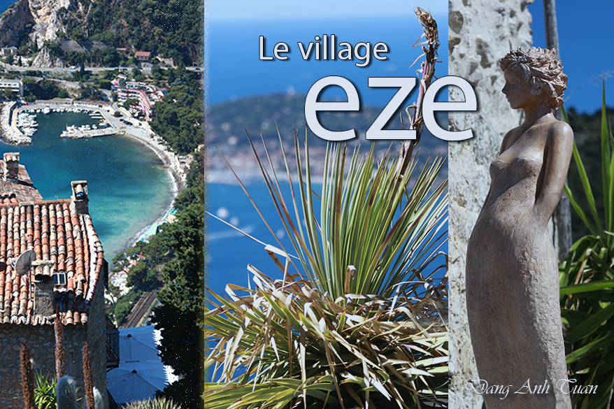
Perché sur un piton rocheux  de 429 mètres d’altitude entre le Ciel et la Mer avec ses ruelles pavées et sinueuses et ses maisons étagées bien fleuries  le faisant  passer pour un dédale, le village médiéval Eze est situé entre Nice et Menton et à 8km de la principauté de Monaco dans le département Alpes-Maritimes. Il est connu pour son église baroque Notre-Dame de l’Assomption et son jardin exotique aménagé sur les ruines de la forteresse médiévale. C’est ici qu’on voit  s’installer une véritable harmonie où les sculptures longilignes en terre cuite de l’artiste-sculpteur Jean-Philippe Richard côtoient les plantes succulentes des régions désertiques d’Amérique du Nord et du Mexique (cactus,  agaves, aloès, euphorbes etc.) et de la  Méditerranée. C’est aussi ici que le visiteur peut  contempler  un panorama magnifique  sur la Riviera française en contrebas. Le village est riche en histoire. À l’image de tous les villages de la région méditerranéenne, les Romains occupèrent ce lieu, dès le 3ème siècle après J.-C. en le faisant devenir un oppidum romain pour faire face à tous les envahisseurs. Puis c’est aussi  par une petite porte nommée  aujourd’hui « porte des Maures » que  les Sarrasins réussirent à prendre la cité en l’an 900 à l’époque où ils dévastaient la  Provence et la Ligurie  pendant plus de 70 ans jusqu’à sa  libération par le comte de Provence, Guillaume 1er. La cité  fut rattachée  ensuite en l’an 1388 à la couronne de Savoie qui apportait beaucoup de modifications à caractère défensif  dans la protection de la cité par une  double porte connue sous le nom « Poterne » avant d’être rattachée définitivement à la France  lors d’un vote à l’unanimité des Ézasques les 15 et 16 avril 1860.

Khu vưòn kỳ lạ

Toàn cảnh Riveira

EZE_JARDIN

Version anglaise
  

Perched on a rocky peak 429 meters above sea level between the Sky and the Sea, with its cobbled and winding streets and its well-flowered terraced houses that make it seem like a maze, the medieval village of Eze is located between Nice and Menton and 8 km from the Principality of Monaco in the Alpes-Maritimes department. It is known for its Baroque church Notre-Dame de l’Assomption and its exotic garden laid out on the ruins of the medieval fortress. Here, a true harmony can be seen where the elongated terracotta sculptures of the artist-sculptor Jean-Philippe Richard stand alongside succulent plants from the desert regions of North America and Mexico (cacti, agaves, aloes, euphorbias, etc.) and the Mediterranean. It is also here that visitors can admire a magnificent panorama of the French Riviera below. The village is rich in history.

Like all the villages in the Mediterranean region, the Romans occupied this place from the 3rd century AD, turning it into a Roman oppidum to defend against all invaders. Then, it was also through a small gate now called the « Moor’s Gate » that the Saracens managed to take the city in the year 900, at a time when they were ravaging Provence and Liguria for more than 70 years until its liberation by the Count of Provence, William I. The city was then attached in 1388 to the Crown of Savoy, which brought many defensive modifications to protect the city with a double gate known as the « Poterne » before being definitively attached to France following a unanimous vote by the Ézasques on April 15 and 16, 1860.

The maze of Eze (Mê cung Eze)

EZE_VILLAGE

Version vietnamienne 

Nằm trên một đỉnh núi đá cao 429 mét so với mực nước giữa Trời và Biển với những con đường lát đá và quằn quèo  cùng những ngôi nhà nhiều tầng nở  đầy hoa khiến nơi đây trông giống như một mê cung, ngôi làng thời trung cổ Eze được tọa lạc cách xa công quốc Monaco 8 cây số giữa hai thành phố Nice và Menton và ở trong  địa phận Alpes-Maritimes . Làng nầy  được biết đến với nhà thờ Notre-Dame de l’Assomption kiểu phong cách baroque và khu vườn nhiệt đới  được hoàn tất trên phế tích của một pháo đài ở thời trung cổ. Chính tại đây, được thấy  có sự hài hòa của các tác phẩm điêu khắc bằng đất nung thanh mảnh  của nhà điêu khắc Jean-Philippe Richard được dựng bên cạnh các loài thực vật mọng nước  đến từ các vùng sa mạc của Bắc Mỹ và Mexico (như  xương rồng, cây thùa, lô hội, euphorbias, vân vân) và Địa Trung Hải. Cũng tại đây, du khách có thể nhìn xem  một phong cảnh tuyệt vời của vùng duyên hải Pháp ở phía dưới. Ngôi làng nầy rất giàu về lịch sử. Giống như các làng ở khu vực Địa Trung Hải, người La Mã đã chiếm đóng nơi này từ thế kỷ thứ 3 sau Công nguyên bằng cách biến nó thành một thành lũy (oppidum) kiên cố để  chống lại quân xâm lược. Sau đó, nhờ thông qua một cánh cửa nhỏ nay gọi là  « cửa của người Moor », người Hồi giáo đã thành công  chiếm được thành vào năm 900 khi họ tàn phá Provence và Liguria có hơn 70 năm cho đến khi được bá tước của Provence, Guillaume đệ nhất giải phóng. Làng nầy được thuộc sau cùng về vương quốc Savoie vào năm 1388. Vương quốc  nầy thực hiện  nhiều sửa đổi mang tính chất phòng thủ trong việc củng cố  thành lũy  qua cánh cửa đôi được biết đến nay với cái tên « Poterne » trước khi  thành được trở về  vĩnh viễn dưới quyền cai trị của Pháp trong một cuộc bỏ phiếu nhất trí của người  dân ở Eze vào ngày 15 và 16 tháng 4 năm 1860.

[Return VILLES DE FRANCE]


Petite Andalousie au cœur de Paris


Tiểu Andalusia ở giữa lòng Paris

[Return PARIS et ses sites]

Parc Montsouris (Công viên Montsouris)

Parc Montsouris (Công viên Montsouris)

Version vietnamienne
Version anglaise
Galerie des photos en été
Galerie des photos en automne

Situé en face de la cité universitaire dans le 14ème de Paris,  le parc de Montsouris fut construit sous l’empereur Napoléon III et inauguré en 1869. C’est un lieu de détente préféré par la plupart des étudiants parisiens. C’est aussi qu’on retrouve aussi la plupart des concerts organisés gratuitement au kiosque à musique durant l’été.

Nằm đối diện với  ký túc xá ở quận 14 của Paris,  công viên Montsouris được xây dựng dưới thời hoàng đế Napoléon III và khánh thành vào năm 1869. Đây là nơi thư giãn được đa số sinh viên yêu thích. Chính ở nơi nầy hay thường  thấy các buổi hòa nhạc được tổ chức miễn phí ở ki- ốt  âm nhạc  trong suốt mùa hè.

Located opposite the university campus in the 14th arrondissement of Paris, the Parc de Montsouris was built under Emperor Napoleon III and inaugurated in 1869. It is a favorite place of relaxation for most Parisian students. It is also where most of the free concerts held at the bandstand during the summer take place.

Mùa hè (en été)

No Images found.

Mùa thu (en automne)

[Return PARIS et ses sites]

Cà Mau (Pointe de Cà Mau)

Version française

Version anglaise

Cà Mau (tiếng Khơ Me gọi là Teuk Khmao) là một thành phố nằm ở cực phương nam của nước đất nước Việt Nam. Đi đến Cà Mau phải qua không biết bao nhiều các cầu nhỏ  để nói lên  Cà Mau là một vùng đầm lầy và thuộc về  đồng bằng sông Cửu Long. Cà Mau đươc biết đến nhờ có  vườn quốc gia U Minh Hạ. Đây là một trong ba vùng lõi của Cà Mau, được UNESCO công nhận là khu dự trữ sinh quyển thế giới. Rất phong phú về động và thực vật, vườn quốc gia  U Minh Hạ  có khoảng 250 loài thực vật, 182 loài chim, 40 loài thú, 20 loài bò sát cùng nhiều loại côn trùng khác nhau.  Ở  xung quanh Mũi Cà Mau là vùng biển cạn. Hàng năm đất lấn ra biển hàng trăm thước. Vì vậy mà từ bao nhiêu thế hệ, người dân Cà Mau thường hay nói với câu ngạn ngữ nầy: « Mắm đi trước, đước theo sau » trong cuộc  hành trình lấn biển. Các cây mắm nhờ có rễ ăn sâu trong đất bùn nên bồi được thêm đất phù sa. Rễ cây đâm tua tủa và chỉa lên mặt đất cùng nhau giữ đất. Sau đó là đến phiên đước và những cây rừng ngập mặn khác như sú, vẹt… cùng đua nhau mọc  lên khiến bãi bồi ngày càng vững chắc thêm để  vươn ra biển.

Version française

Cà Mau (connue en khmer sous le nom de Teuk Khmao) est une ville située à l’extrême sud du Vietnam. En venant ici, il faut traverser tant de petits ponts pour rappeler bien que Ca Mau est une région marécageuse  du delta  du Mékong.  C’est l’une de ses trois zones importantes reconnues  par l’UNESCO comme réserve de biosphère mondiale. Très riche de faune et de flore, le parc national U Minh Ha compte environ 250 espèces de plantes, 182 espèces d’oiseaux, 40 espèces de mammifères, 20 espèces de reptiles et de nombreux types d’insectes différents. Autour du cap Cà Mau c’est la zone où la mer est peu profonde. Chaque année, la terre empiète sur la mer à des centaines de mètres. C’est pour cela que depuis des générations, les habitants de Cà Mau ont l’habitude de dire en vietnamien: » les plantes mắm (Avicennia)  poussent d’abord, puis elles sont suivies par les palétuviers » dans  leur empiétement sur la mer. Grâce à de longues racines fixées dans les bancs de vase, les Avicennias facilitent le dépôt des alluvions marines. Leurs racines ramifiées s’orientent dans toutes les directions hors du sol et réussissent à retenir ensemble ce dépôt. Puis  c’est le tour des  palétuviers et des autres plantes capables de pousser dans cet environnement  permettant  d’affermir ainsi l’extension de la vasière.

Version anglaise

Ca Mau (known in Khmer as Teuk Khmao) is a town in the extreme south of Vietnam. On the way here, you have to cross many small bridges to realize that Ca Mau is a marshy region of the Mekong Delta. It is one of three important areas recognized by UNESCO as a world biosphere reserve. Rich in flora and fauna, U Minh Ha National Park boasts some 250 plant species, 182 bird species, 40 mammal species, 20 reptile species and many different types of insect. Around Cape Cà Mau is the zone where the sea is shallow. Every year, hundreds of meters of land encroach on the sea. This is why, for generations, the inhabitants of Cà Mau have been used to saying in Vietnamese: “the mắm plants (Avicennia) grow first, then they are followed by the mangroves” in their encroachment on the sea. Thanks to long roots fixed in the mud banks, Avicennias facilitate the deposition of marine alluvium. Their branching roots reach out from the soil in all directions, holding the deposit together. Then it’s the turn of the mangroves and other plants able to grow in this environment, helping to consolidate the extension of the mudflat.


Le Clos Normand de Claude Monet (Giverny)

Version française
Version anglaise
Galerie des photos

Nhờ việc nới rộng khu vườn « Clos Normand » và sửa đổi nguồn nước sông  Ru, Monet đã thành công tạo cho khu vườn nầy  có được một diện tích 1000 m2 và một hình dáng tuyệt vời mà du khách có cơ hội chiêm ngưỡng ngày nay  khi đến tham quan Giverny. Năm 1895, ông bắt đầu vẽ khu vườn của mình.  Khu nầy  không ngừng sung túc và phong phú thêm với các loài cây cỏ mà ông chọn trồng theo ý mình. Nhờ  đó, ông thực hiện hơn 250 bức tranh tuyệt vời từ nhiều góc độ nhìn khác nhau. Nhưng các hoa súng vẫn là chủ đề chính và quyén rũ ông đến nổi  qua các bức tranh của ông, các cảnh vật chỉ được vẽ sơ sài để nổi bật các hoa súng ưa thích.  Khu vườn nầy giúp ông có nguồn cảm hứng vô tận và  được xem từ đây như là một tuyệt phẩm nghệ thuật vẹn toàn 

Version française

Grâce à l’agrandissement du Clos Normand et à la modification du cours d’eau du Ru, Monet réussit à donner à son jardin d’eau couvrant désormais 1000m2 l’aspect actuel que le visiteur a l’occasion de contempler avec admiration  lors de sa visite à Giverny. Il se mit à peindre en 1895 son jardin d’eau renouvelé incessamment par de nouvelles plantations et par l’abondance de la végétation choisie avec soin par lui-même. Cela lui permit de réaliser  avec ingéniosité un ensemble de plus de 250 tableaux  sous de nombreux angles de vue différents. Mais les nymphéas constituent le sujet  principal dans ses tableaux  et captent son attention si bien que le paysage y est dessiné  simplement pour dégager  la beauté de ses fleurs préférées.   Son jardin d’eau lui donna  ainsi une source d’inspiration inépuisable et s’intégra désormais comme une œuvre d’art à part entier. 

Version anglaise

Thanks to the enlargement of the Clos Normand and the modification of the course of the Ru stream, Monet succeeded in giving his water garden, now covering 1000m2, the current appearance that visitors have the opportunity to admire during their visit to Giverny. He began painting his water garden in 1895, which was continuously renewed by new plantings and the abundance of vegetation carefully chosen by himself. This allowed him to ingeniously create a collection of more than 250 paintings from many different viewpoints. But the water lilies are the main subject in his paintings and capture his attention so much that the landscape is simply drawn to highlight the beauty of his favorite flowers. His water garden thus provided him with an inexhaustible source of inspiration and became, from then on, a work of art in its own right.

Galerie des photos

Une ballade mémorable dans le jardin de Monet (Giverny, Haute Normandie)

Cùng nhau đi dạo trong vưòn của họa sỹ tài hoa Monet (Giverny)

[Return VILLES DE FRANCE]

Hanoï c’est quoi en chacun de nous?


Hà Nội là gì trong mỗi chúng ta?
Hanoï c’est quoi en chacun de nous?

What is Hanoi in each of us?

Pictures gallery

Hà Nội là bát bún ngan giản dị ? Là những ghế nhựa ngồi bệ? Là gánh hàng rong với chiếc đòn gánh là cầu Long Biên còn người gánh lại là một cô robot ? Hay là Hànội là… Đây là cuộc thi vẽ minh họa thuộc dự án Hanoi Rethink được tổ chức bởi UNESCO với sự đồng hành của nhóm Vietnam local Artist Group.

Hanoï c’est quoi en chacun de nous ? Hanoï est-elle un simple  bouillon de canard  aux vermicelles ? Ou ce sont les  chaises basses en plastique ? Ou le vendeur ambulant dont  la palanche est le pont Long Bien et qui est en fait un robot ?  Ou bien Hanoi est … C’est le concours d’illustration appartenant au  projet Hanoi Rethink organisé par UNESCO en collaboration avec le groupe Vietnam local Artist.

What is Hanoi in each of us? Is Hanoi just a simple duck broth with vermicelli? Or is it the low plastic chairs? Or the street vendor whose carrying pole is the Long Bien Bridge and who is actually a robot? Or is Hanoi… It is the illustration contest belonging to the Hanoi Rethink project organized by UNESCO in collaboration with the Vietnam Local Artist group.

Pictures Gallery

[RETURN]

Stèle commémorative (Bia Tưởng Niệm)


Version française
Version anglaise

Đựợc gọi là Bia Quốc học, công trình nầy xây cất vào đầu thế kỷ 20 để tưởng niệm những binh sỹ người Pháp và Việt đã hy sinh trong chiến tranh thế giới lần thứ nhất chống Đức. Công trình nầy được chọn theo mẫu thiết kế của họa sỹ xuất sắc trong ngành mỹ thuật đồ họa, Tôn Thất Sa, hậu duệ  của chúa Nguyễn Phúc Chu. Đài được khởi công xây dựng ngày 12 tháng 5 năm 1920 và đã có hơn một trăm năm.  Theo  ông Nguyễn Đình Hoè, đài nầy được dựng theo dáng một bình phong lớn, có mái che, hai tầng và trên nền có bậc thềm. Các hoạ tiết trang trí, kiến trúc, điêu khắc đều mang phong cách kiến trúc của thời Nguyễn. Vì thế nên không bị hũy phá mà còn được sùng tu lại trông rất xinh xắn và hài hoà với quan cảnh hài hoà của sông Hương và trước mặt trường Quốc Học.

Étant appelée maintenant « Bia Quốc Học (Stèle de l’École Nationale)», cette stèle commémorative a été édifiée au début du XXème siècle pour se souvenir des soldats français et vietnamiens morts lors de la Première Guerre mondiale contre l’Allemagne. Ce monument  a été sélectionné selon le modèle proposé par  l’artiste de son temps dans l’industrie des arts graphiques, Tôn Thất Sa, un descendant du seigneur Nguyễn Phúc Chu. Sa construction commença  le 12 mai 1920 et data aujourd’hui plus de cent ans. Selon Mr. Nguyễn Đình Hoè, ce monument a été édifié sous la forme d’un grand paravent doté d’un toit, comportant deux étages  et établi sur une plate-forme avec des marches. Les motifs décoratifs, l’architecture et la sculpture sont tous dans le style architectural de la dynastie des Nguyễn. C’est pour cela qu’il n’a pas été détruit. Par contre, sa rénovation récente est superbe et en harmonie  avec le cadre enchanteur de la rivière des Parfums et en face de l’École Nationale de Huế.

Now called the « Bia Quốc Học (Stele of the National School), » this commemorative stele was erected at the beginning of the 20th century to remember the French and Vietnamese soldiers who died during the First World War against Germany. This monument was selected according to the model proposed by the artist of his time in the graphic arts industry, Tôn Thất Sa, a descendant of the lord Nguyễn Phúc Chu. Its construction began on May 12, 1920, and today it is over a hundred years old. According to Mr. Nguyễn Đình Hoè, this monument was built in the form of a large folding screen with a roof, consisting of two levels and established on a platform with steps. The decorative motifs, architecture, and sculpture are all in the architectural style of the Nguyễn dynasty. That is why it was not destroyed. On the other hand, its recent renovation is superb and in harmony with the enchanting setting of the Perfume River and opposite the National School of Huế.


[Return Huế]

Huế au fil de la nuit (Huế về đêm)

Huế au fil de la nuit

[Return Huế]