Version anglaise
Version française
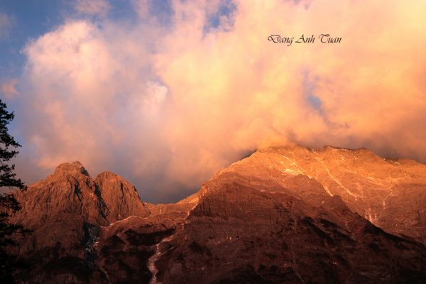
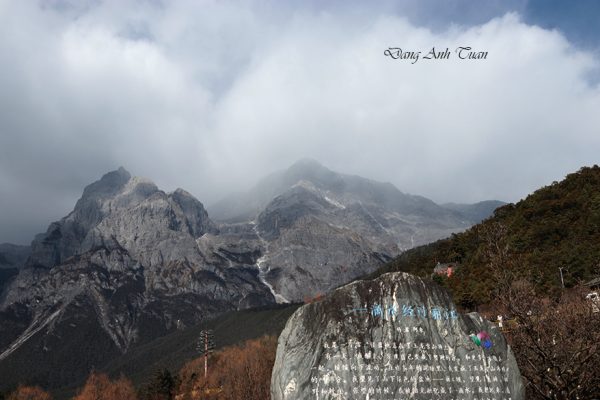
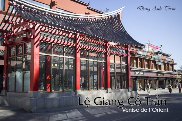
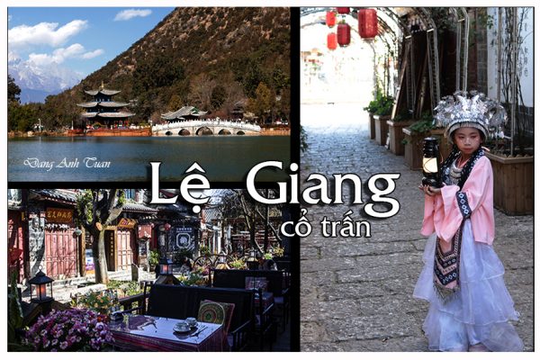
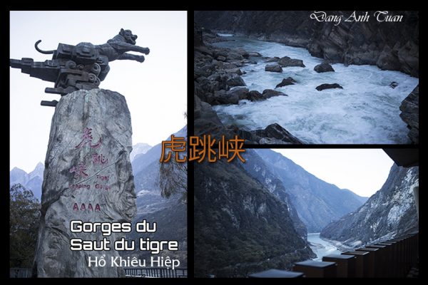
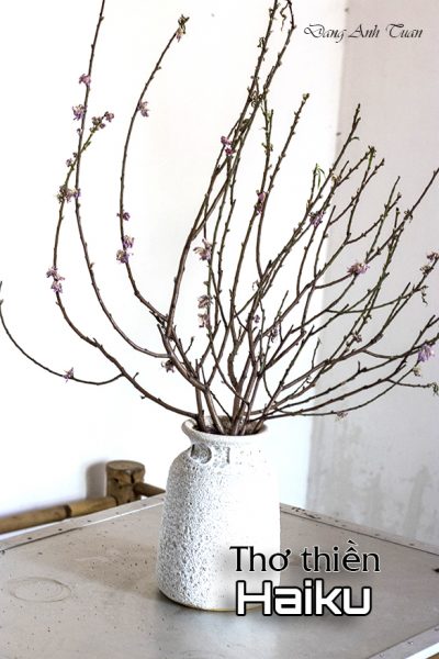
Galerie des photos
Thiền là một hoạt động được người hành thiền thực hiện bằng cách tập trung tâm trí vào một đối tượng nào để rèn luyện sự chú ý và nhận thức và để tìm kiếm mỗi ngày, một tâm trí thanh tịnh và trong sáng được thanh lọc vào một khoảnh khắc nào để thời điểm của sự kết hợp nhất với cuộc sống trở thành việc giảng dạy quan trọng nhất trong Phật giáo. Nó giúp con người trầm tư chiêm nghiệm một vấn đề nào đó của cuộc sống và vũ trụ và dẫn đến giai đọan giác ngộ (thức tỉnh) khi con người thấu triệt được những nguyên lý vận hành sự biến dịch của vạn vật trong tự nhiên. Chữ Thiền (zen) trong tiếng Hán là 禅, phiên âm /chán/ nhưng chữ nầy trong tiếng phạn, một cổ ngữ trong nền văn hóa Ấn Độ là dhyana (thiền na).
Con đường Thiền hiện diện trong cuộc sống thường ngày. Mặc dù Thiền được nhà sư Bồ Đề Đạt Ma (Bodhidharma) mang từ Ấn Độ sang đến Trung Quốc vào năm 520, nhưng ngày nay nó lại nổi bật nhất ở Nhật Bản so với các nước châu Á khác, luôn kể cả Việt Nam. Con đường Thiền ở Nhật Bản phát triển mạnh mẽ trong các nghệ thuật và các bộ môn thông qua nhiều hình thức thiền định và học tập: trà đạo (chado), hoa đạo (kado), kiếm đạo (kendo) vân vân. Nhưng điều quan trọng nhất ở dưới những hình thức này là sự cảm nhận khoảnh khắc hiện tại: ở đây và bây giờ. Chỉ có nghệ thuật thơ haiku mới có thể nắm giữ được khoảnh khắc nầy trong thực tế. Chính sự gặp gỡ chớp nhoáng này đã làm cho haiku trở thành thơ ca của Thiền, và việc đọc thơ haiku làm tăng thêm cảm giác hạnh phúc và bình yên cho cả nhà thơ lẫn người đọc.
Theo nhà văn Lê Tấn Dương, ngôn ngữ dùng trong thơ thiền Haiku có mang tính cách trực tiếp không phải suy luận bằng lý trí (trực cảm). Nếu còn suy nghĩ thì còn gì là cảm quan trực giác. Dù tính thiền vẫn còn đó nhưng nó không còn ảo diệu nữa. Ngược lại nó rất quan tâm đến những điều nhỏ bé, những chi tiết, lòng từ bi và niềm đam mê mà nó dành cho khoảnh khắc hiện tại.
Haiku là một thể thơ rất đơn giản chớ nó không bị giới hạn ở việc miêu tả đơn thuần. Nó có thể là sự phát triển của một hình thức thơ cổ của Nhật Bản gọi là katauta, theo cùng một mô hình 5-7-5 âm tiết, tổng cộng là 17 âm tiết và tương ứng chính xác với độ dài của một hơi thở. Haiku không nhất thiết phải có vần.
Tuy nhiên thơ thiền Haiku nó cũng có hai quy tắc cần tuân thủ :
- một kigo, tức là một khái niệm về mùa, để làm bối cảnh;
- và một gạch nối (césure) hay kireji, sẽ cắt bài thơ thành hai phần.
Haiku hay thường giữ cái ẩn ý hơn là cái rõ ràng, do đó kigo chỉ nên mang tính gợi mở. Như thường lệ, thơ Haiku không thể tách rời các mùa. Việc viết thơ gợi mùa thì quá dễ dàng, thay vào đó thi gia haiku sẽ thích nhắc nhở hơn về “tiếng dế” hay “hoa mao lương”. Kireji, ngược lại, cho phép chuyển từ một miêu tả đơn giản của một hình ảnh sang cảm nhận mà nó tạo ra ở tác giả. Nó không chỉ đơn thuần đồng nghĩa với « sự tĩnh lặng » hay « sự an lạc ». Những ham muốn, cảm xúc, thậm chí cả suy nghĩ đều phải được gạt bỏ. Quá trình thanh lọc này có thể bao gồm cả việc quên đi « cái tôi » để dẫn đến giác ngộ và để có cái nhìn trầm tư hơn và tự do hơn về thế giới, thoát khỏi mọi sự tìm kiếm ý nghĩa. Điều đó còn tùy thuộc sự rung cảm từ tâm thức của người viết và người đọc mà còn luôn cả mức độ giác ngộ của mỗi người về cảnh quan và cuộc sống. Có nguời đi suốt cuộc đời vẫn chưa giác ngộ, còn có người có duyên thì giác ngộ đến rất sớm. Con đường lớn (hay con đường Thiền) không có cổng; hàng ngàn con đường dẫn đến đó. Ai đi qua cánh cổng không lối này sẽ tự do đi lại giữa Trời và Đất, đó là lời nhắn nhũ cho những ai học thiền.
Thơ haïku là sự diễn giải của một trải nghiệm chớ không phải môt bình luận. Chính vì vậy haïku hay thường được so sánh với một bức tranh trong đó quan sát và kinh nghiệm là một với ý thức. Thi ca haiku là một bức tranh toàn diện không thừa không thiếu với 17 âm tiết, ngôn dủng trong thi ca là trực giác. Theo nhà văn nhà văn Manuela Dunn Mascetti, sự tươi mát là bông hoa của nghệ thuật haïku vì nó được tạo ra bởi sự tức thời của cảm giác khiến người đọc có được niềm vui thật sự và vĩnh cửu. Nhưng muốn có được tinh thông nghệ thuật haiku thì cần có nhiều năm luyện tập. Chìa khóa thảnh công là đạt được hay là mất đi thì cũng giống như một trãi nghiệm sống. Tuy thơ thiền haiku vuợt qua biên giới ngày nay với một số tín đồ ngoại quốc nhưng chỉ có những bậc thầy nổi tiếng như Matsuo Basho (1644-1694), Yosi Buson (1718-1783), Kobayashi Isa (1763-1827) hay Natsume Soseki (1867-1916) vẫn tiếp tục làm rung chuyển trái tim chúng ta ở mỗi giây phút hiện tại với các bài thơ độc đáo mang đậm chất thiền và còn giúp đỡ ta trong việc thiền định. Ngoài ra, haiku còn là một thú vui nho nhỏ trong cuộc sống, giúp ta tạm quên đi những lo lắng thường ngày. Cùng nhau thử phân tích bài thơ nổi tiếng « con ếch » của thiền nhân Basho dưới đây:
Ao cũ Furu ike ya
Con ếch nhày vào kawazu tobikomu
vang tiếng nước xao mizu no oto
(Matsuo Basho- Nhât Chiêu dịch)
Cái tên Basho nầy gắn liền với ông từ khi ông về sống ở cái lều nhỏ mà bên cạnh có trồng cây chuối (ba tiêu). Vì vậy ông tự gọi ông là Basho và nơi ông ở là am ba tiêu. Bài thơ haiku nầy có vẻ đẹp đơn sơ của ao cũ, lấy động tả tĩnh,nhẹ nhàng, trong sáng mà còn gần với đời sống thường ngày qua việc chú ý quan sát sinh vật nhỏ bé “con ếch”. Kigo ở đây là con ếch tức là mùa xuân. Âm thanh tiếng nước mà con ếch khuấy động còn mãi âm vang vọng trong tâm hồn lúc Basho đang ngồi tham thiền. Qua cái nhìn trực cảm trước sự việc nầy, Basho giác ngộ ra cái thâm sâu về bản chất huyền nhiệm cũa sự hiện hữu, thấu triệt vận hành sự biến dịch của vạn vật trong tự nhiên và con đường sâu thẳm mà ông xem như là khúc giao hưởng của một tâm hồn đang hoà nhập với thế giới, là cuộc hành trình về với thiên nhiên vũ trụ tinh khiết.
Version française
La méditation est une activité exercée par les pratiquants en concentrant l’esprit sur un objet afin de développer l’attention et la conscience, et de trouver chaque jour, à chaque instant, un esprit clair et purifié afin que le moment de l’union avec l’existence devienne le plus grand enseignement dans le bouddhisme. Elle aide les individus à approfondir un certain problème de la vie et de l’univers et à les conduire à la réalisation de l’éveil lorsque les principes régissant le changement de toutes choses dans la nature sont compris parfaitement. Le mot méditation (zen) en chinois est 禅, translittéré /chán/, mais ce mot en sanskrit, une ancienne langue de la culture indienne, est dhyana (thiền na).
La voie du zen réside dans la vie quotidienne. Malgré que le zen fut rapporté d’Inde en Chine par le moine errant Bodhidharma en 520, il devient plus important aujourd’hui au Japon que dans les autres pays d’Asie y compris le Vietnam. La voie du zen japonais s’épanouit dans les arts et disciplines sous diverses formes de méditation et d’apprentissage: chado la voie du thé, kado la voie des fleurs, kendo la voie de l’épée etc. mais ce qui importe le plus dans ces formes, la perception du moment: être ici et maintenant. C’est l’art de haïku qui réussit à encadrer la réalité en un seul instant et qui fait de haïku la poésie du zen japonais. Sa lecture augmente le sentiment de bonheur et de tranquillité au poète et au lecteur.
Le langage utilisé dans la poésie zen Haïku porte le caractère « direct », il ne repose pas sur un raisonnement intellectuel (intuition directe). S’il y a encore la réflexion, il n’y a plus la perception intuitive. Bien que la nature zen soit toujours présente, elle n’est plus magique. Au contraire, elle s’intéresse beaucoup aux petites choses, aux détails, à la compassion et à la passion réservée pour l’instant présent.
Haiku est une forme de poésie très simple, mais elle ne se limite pas à une simple description. Elle est peut-être le développement d’une ancienne forme de poésie japonaise appelé katauta en suivant le même schéma de ce dernier 5-7-5 syllabes, ce qui donne un total 17 syllabes et qui correspond exactement à la longueur d’une respiration. Le haïku ne doit pas forcément faire de rimes.
Le haïku privilégie souvent le sens caché plutôt que le sens clair. Ainsi le kigo ne doit être qu’évoqué. Comme toujours, le haïku est indissociable des saisons. « Écrire des poèmes » évoquant les saisons serait trop facile ; les poètes de haïku préfèrent donc nous rappeler « le chant du grillon» ou « la fleur d’anémone». En revanche, le kireji permet de passer d’une simple description d’une image à la sensation qu’elle suscite chez l’auteur. Le haïku ne signifie pas simplement « silence » ou « paix ». Les désirs, les émotions, voire les pensées doivent être écartées. Ce processus d’épuration peut inclure l’oubli du « moi » pour atteindre l’éveil et adopter un regard plus méditatif et plus libre sur le monde, affranchi de toute quête de sens.
Cela dépend de l’émotion dans l’esprit de l’écrivain et du lecteur, mais aussi du niveau d’éveil de chacun sur le paysage et la vie. Certaines personnes passent toute leur vie sans être « éveillées », tandis que d’autres sont prédestinées à ce que l’illumination vienne très tôt. La grande voie n’a pas de porte. Des milliers de routes y débouchent. Celui qui franchit cette porte sans porte marche librement entre le Ciel et la Terre, ce qui constitue le message destiné à ceux qui pratiquent le zen.
La poésie haïku est l’interprétation d’une expérience et non un simple commentaire. C’est pourquoi le haïku est souvent comparé à un tableau où l’observation et l’expérience ne font qu’un avec la conscience. La poésie Haïku est un tableau complet, ni plus ni moins, avec 17 syllabes, le langage utilisé dans la poésie est l’intuition. Selon l’écrivaine Manuela Dunn Mascetti, la fraîcheur est la fleur de l’art de Haïku car elle est créée par l’instantanéité du sentiment qui procure au lecteur une joie véritable et éternelle. Mais pour maîtriser l’art du Haïku, il faut de nombreuses années de pratique. La clé de réussite est soit atteinte soit perdue tout comme une expérience vécue. La poésie zen haiku a franchi les frontières de nos jours avec un certain nombre de pratiquants étrangers, mais ce sont seulement les maîtres célèbres tels que Matsuo Basho (1644-1694), Yosi Buson (1718-1783), Kobayashi Isa (1763-1827) ou Natsume Soseki (1867-1916) qui continuent à émouvoir nos cœurs à chaque instant présent avec leurs poèmes Haiku et qui nous aident encore dans la pratique de la méditation. En plus, haiku est un petit plaisir de la vie qui éloigne votre esprit des tracas ordinaires. Essayons d’analyser ci-dessous le célèbre poème « La Grenouille » du maître zen Basho :
Trong ao cũ Furu ike ya Dans le vieil étang
Con ếch nhày vào kawazu tobikomu Une grenouille saute
Vang tiếng nước xao mizu no oto Un ploc dans l’eau
(Basho)
Le nom de Basho lui fut associé lorsqu’il s’installa dans une petite hutte près d’un bananier. Il se nomma donc Basho et sa demeure le pagodon du bananier. Ce haïku illustre bien la beauté simple d’un vieil étang. Il emploie le mouvement pour dépeindre le calme, la douceur, la pureté et la proximité de la vie quotidienne à travers l’observation d’une petite créature, la « grenouille ». Kigo désigne ici la grenouille, qui fait allusion au printemps. Le bruit de l’eau remuée par le saut de cette rainette résonne dans l’âme de Basho pendant sa méditation. Par cette observation intuitive, le moine Basho s’éveille au profond mystère de l’existence, il comprend le fonctionnement et les transformations de toute chose dans la nature et le chemin profond qu’il perçoit comme la symphonie de l’âme en fusion parfaite avec le monde, un voyage de retour à la nature pure et à l’univers.
Zen is an activity practiced by practitioners by focusing the mind on an object in order to develop attention and awareness, and to find every day, at every moment, a clear and purified mind so that the moment of union with existence becomes the greatest teaching in Buddhism. It helps individuals to deepen a certain problem of life and the universe and to lead them to the realization of awakening when the principles governing the change of all things in nature are perfectly understood. The word meditation (zen) in Chinese is 禅, transliterated /chán/, but this word in Sanskrit, an ancient language of Indian culture, is dhyana (thiền na).
The path of Zen lies in daily life. Although Zen was brought from India to China by the wandering monk Bodhidharma in 520, it is more important today in Japan than in other Asian countries including Vietnam. The Japanese Zen path flourishes in arts and disciplines in various forms of meditation and learning: chado the way of tea, kado the way of flowers, kendo the way of the sword, etc. but what matters most in these forms is the perception of the moment: being here and now. It is the art of haiku that manages to frame reality in a single moment and makes haiku the poetry of Japanese Zen. Its reading increases the feeling of happiness and tranquility in both the poet and the reader.
The language used in Zen haiku poetry carries a « direct » character; it does not rely on intellectual reasoning (direct intuition). If there is still reflection, there is no longer intuitive perception. Although the Zen nature is always present, it is no longer magical. On the contrary, it is very interested in small things, details, compassion, and passion reserved for the present moment.
Haiku is a very simple form of poetry, but it is not limited to a mere description. It may be the development of an ancient form of Japanese poetry called katauta, following the same pattern of the latter 5-7-5 syllables, which gives a total of 17 syllables and corresponds exactly to the length of a breath. The haiku does not necessarily have to rhyme.
Haiku often favors hidden meaning rather than clear meaning. Thus, the kigo should only be evoked. As always, haiku is inseparable from the seasons. « Writing poems » evoking the seasons would be too easy; haiku poets therefore prefer to remind us of « the song of the cricket » or « the anemone flower. » On the other hand, the kireji allows one to move from a simple description of an image to the sensation it arouses in the author. Haiku does not simply mean « silence » or « peace. » Desires, emotions, even thoughts must be set aside. This process of purification can include the forgetting of the « self » to reach awakening and adopt a more meditative and freer view of the world, freed from any search for meaning.
Haiku poetry is the interpretation of an experience and not a mere commentary. That is why haiku is often compared to a painting where observation and experience merge with consciousness. Haiku poetry is a complete picture, neither more nor less, with 17 syllables; the language used in the poetry is intuition. According to the writer Manuela Dunn Mascetti, freshness is the flower of the art of Haiku because it is created by the immediacy of the feeling that provides the reader with true and eternal joy. But to master the art of Haiku, many years of practice are required. The key to success is either achieved or lost just like a lived experience. Zen haiku poetry has crossed borders nowadays with a number of foreign practitioners, but it is only the famous masters such as Matsuo Basho (1644-1694), Yosi Buson (1718-1783), Kobayashi Issa (1763-1827), or Natsume Soseki (1867-1916) who continue to move our hearts at every present moment with their Haiku poems and who still help us in the practice of meditation. Moreover, haiku is a small pleasure of life that takes your mind away from ordinary worries. Let us try to analyze below the famous poem « The Frog » by the Zen master Basho:
Dans le vieil étang
Une grenouille saute
Un ploc dans l’eau
(Basho)
In the old pond
A frog jumps
A splash in the water
(Basho)
The name Basho was associated with him when he settled in a small hut near a banana tree. He thus named himself Basho and his home the banana tree pagoda. This haiku beautifully illustrates the simple beauty of an old pond. It uses movement to depict calm, gentleness, purity, and the closeness of daily life through the observation of a small creature, the « frog ». Kigo here refers to the frog, which alludes to spring. The sound of the water stirred by the leap of this tree frog resonates in Basho’s soul during his meditation. Through this intuitive observation, the monk Basho awakens to the profound mystery of existence; he understands the functioning and transformations of all things in nature and the deep path he perceives as the symphony of the soul in perfect fusion with the world, a journey back to pure nature and the universe.
Pictures Gallery
Bibliographie.
Manuela Dunn Mascetti: The Little Book of Zen . Evergreen 2007
Lê Tấn Dương: Thiền trong văn hóa Nhật Bản. Đặc san Lâm Viên.