Tự Đức mauseolum ( English version)

Version française


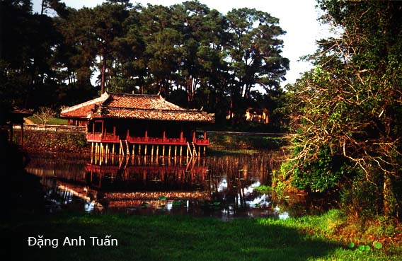
Xung Khiêm Tạ

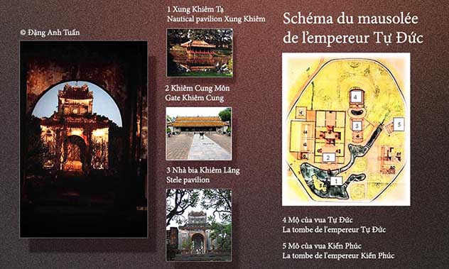
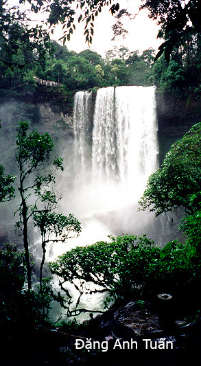
Unlike other royal tombs of the Nguyễn Dynasty, Tự Ðức mausoleum  is primarily a possible place of refuge during his reign. That is why there is not only a palace which was later transformed into a place of worship after his death but also a theater and two small and pretty pavilions in red wood (Du Khiêm and Xung Khiêm) where he liked to sit for the relaxation and the composition of his poems. This mausoleum which was built during 1864-1867 by three thousand soldiers and workers, had approximately fifty buildings surrounded by a stone and brick wall 1500 meters in length in an area of 12 ha.

Khiêm Lăng (謙陵)

Tự Đức was crowned king at a time where he have had to cope not only with development of Western capitalism but also internal strife (war grasshoppers led by  poet Cao Ba Quát, the eviction of his elder brother Hồng Bang at his enthronement etc..). For taking refuge, he did not hesitate to order the construction of his tomb as a place of relaxation in his lifetime and remains a place of residence for eternal future life.


Pictures gallery

In this mausoleum, the pavilion Hoa Khiêm is the main building where the Emperor worked and the pavilion Lương Khiêm is where he lived and slept. One finds also in the domain of his mausoleum two other tombs: those of his wife, Queen Lê Thiện Anh and one of his three adopted son, King Kiến Phúc.

The architecture of this mausoleum reflects not only the nature of the romantic poet emperor Tư Ðức but also the freedom that is lacking so far in the other mausoleums. Nothing is surprising to see this mausoleum become one of the favorite places choosen by most foreign and Vietnamese tourists.

 
lang_tu_duc


Mausoleum of Minh Mạng emperor (English version)

Version française

lang_minh_mang

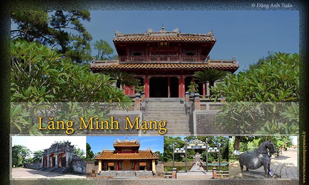
Each royal tomb has a particular landscape and a own charm. That of Minh Mang is known for perfect harmony between architecture and  natural environment. It began to be built during his reign (1820-1841) and was completed only in 1843, two years after his death by his successor Thiệu Trị.

The temple Sung Ấn , dedicated to Minh Mang and his wife by his successor, may be achieved through  three terraces and the gate Hiền Ðức. On the other side of this temple, there are three stone bridges spanning Lake Pure Clarity. (Hồ Minh Trung). The central bridge known as the « bridge of the Intelligence and righteousness » (Trung Ðạo Kiêu , built in marble was used only by the emperor. Pavilion Minh Lâu (Pavilion of Light) represent the Triad: Heaven, Human being and the Earth. (Thiên Nhân Ðịa).

Trung đạo kiều

Hiếu Lăng (孝陵)

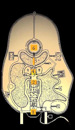
From a stone bridge spanning the lake Tân Nguyệt (Lake of the New Moon), one can reach through a gate in bronze, a circular wall symbolizing the sun and in the middle of this sacred fence it is the emperor ‘s tomb, a mound of soil surrounded by natural pines.

Map of  the Minh Mạng emperor mauseoleum

langminhmang1


  • 1 Ðại Hồng Môn
  •   The red main gate
  • 2 Sùng Ấn Ðiện
  •   The cult of temple
  • 3  Hoàng Trạch Môn
  •    The Hoàng Trạch gate  of pavilion of light
  • 4  Minh Lâu
  •    The pavilion of light
  • Trung Ðạo Kiều
  •     The bridge of the Intelligence and righteousness
  • 6  Mộ của vua Minh Mạng
  •      The mausoleum of Minh Mang emperor


 Pictures gallery

Forbidden city of Huế (Tử Cấm Thành)

Version française

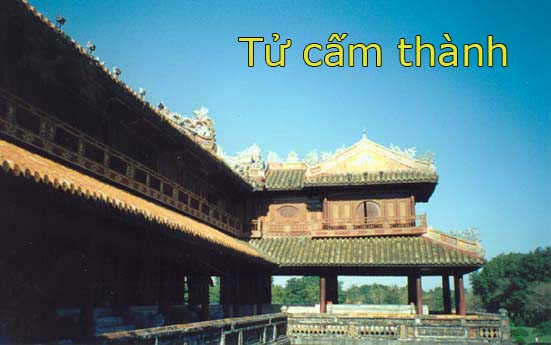
The forbidden city   is encircled by a 4-metre high  brick wall with a classic coating. This wall also is  surrounded by a ditch filled with water. Each door preceded by one or several bridges gives access on each side. The Ngọ Môn Gate is the main entrance and it is reserved for the King.

It is a powerful  masonry  foundation drilled with five passages and surmonted by an elegant wooden structure with two levels, the Belvedere of five Phoenixes (Lầu Ngủ Phụng). In the East and West of the Citadel, one finds respectively  the gates  of humanity and virtue which are highly decorated and pierced each by  three passages. The gate of humanity has been completely  restored in 1977.

World cultural heritage of Vietnam

Once we have gone precisely through the Ngo Môn Gate, we see appearing on the main axis the sumptuous palace of Supreme Harmony or  Throne palace that can be reached through the Esplanade of the Great Salvation (Sân Ðại Triều Nghi). It is in this Palace that the emperor, seated in a prominent symbolic position, received the salvation of all dignitaries of the empire  hierarchically aligned  on the esplanade at the time of great ceremonies. It is also the only building kept after so many years of war. Behind this palace, it is the imperial residence.

© Đặng Anh Tuấn

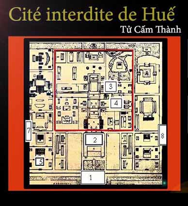
schema_noithanh1


  • 1 Noon gate (Ngọ Môn)
  • 2 Throne palace (Điện Thái Hoà)
  • 3 Archives pavilion  ( Thái Bình Ngự Lâm Thư Lâu)
  • 4  Royal theatre ( Duyệt Thị Đường)
  • 5 Pavilion of  Splendor (Hiến Lâm Các)
  • 7 Gate of virtue (Hiền Đức Môn)
  • 8 Gate of humanity (Hiển Nhơn Môn)

Pictures gallery


Huế city (English version)


titre_hue 

Version française

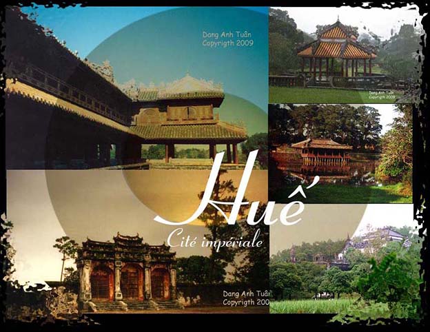
For the majority of Vietnamese, Huế always remains the intellectual and artistic foyer of Vietnam. It always looks like a sleeping princess. It knows how to keep its charm and grace that it has had since the Champa occupation with its citadel, the Perfume river and above all the famous Thiên Mụ ( or The Celeste Lady ) pagoda . The cruel beauty of its women wearing the white tunic ( áo dài ) accompanied by a conical hat (or nón bài thơ) , the fineness of its poetry, the union of its parks and pagodas with varnished tiles, the culture of its madarinal court make it more charming, noble, and majestuous.

One remembers Hue through the follwing two famous popular verses:

Gió đưa cành trúc là đà
Tiếng chuông Thiên  Mụ, canh gà Thọ-Xương

While the wind smootly moves the bamboo branches 
One hears the Thiên Mụ bell, and the Thọ-Xương rooster’s song

Before becoming the imperial capital of the Nguyễn, it was first the strong place of Chinese Jenan’s command of emperorQin ShiHuangDi in 3rd century B.C., then it was gradually integrated in the kingdoms of Lin Yi and Champa since 284 of our era. Then it was the object of greed of the Chinese and the Vietnamese when the latter  gained their independence. It was partially controlled by the Vietnamese in 1306. This control was only wholly when Hue became a dowry from king Chế Mẫn of Champa to the Vietnamese in exchange of his marriage with princess Huyền Trân.

Cố Đô Huếtucam

It was the imperial capital of a reunified Vietnam from 1802 to 1945 and knew no less than 13 emperors of the Nguyễn dynasty, of whom the founder was Nguyễn Ánh known under the name of  » Gia Long ». On the left bank of the Perfume river, in the middle of the city center, three surroundding walls circumscribe the imperial city and protect the forbidden purple city whose orientation was set in relationship with four cardinal points by geomancers of the court. As an admirer of the Ming dynasty, emperor  Gia Long did not hesitate to give Huế a striking resemblance of the Forbidden City of Peking.

Pictures gallery

The royal tombs were built  at the exit of the city, along the river. Hue was the target of several conquests, French first in 1885, Japanese next in 1945 and then French in 1946. It was the witness of deadly combats during the Mậu Thân Tết offensive in 1968. Many times, it was also the actor of nationalist resistance in colonial time and during the last five decades.

Despite its aristocratic appearance, Huế knows how to conserve in difficult time the history of Vietnam that is to say the Vietnamese soul.

Beautiful landscapes of Vietnam


French version

The landscape of Vietnam is really magnificent and exceptional.  For an avid photographer, it is the ideal place where he can make beautiful pictures for  immortalizing his trip. From North to South, the landscape is so  contrasted that it is impossible to remain indifferent to the  breath-taking beauty of nature.

Pictures gallery

phongcanh

Phong cảnh hữu tình 

In the North, one is amazed by atonishing and majestic  peaks emerging    from clean waters and islets with various forms in  Along and Hoa Lư bays and  rice terraces used by minority ethnic groups  in the heart of the mountains (Sapa, Mộc Châu, Mai Châu, Hà Giang, Yên Bái, Cao Bằng). In the central region, in addition to Phong Nha-Kẻ Bàng and Sơn Động  stalactite caves and world heritages of Unesco (Huế, Mỹ Sơn, Hội An),  there are beautiful beaches (Mỹ Khê, Hội An, Nha Trang ) and national parks (Yok Don, Nam Cát Tiên).  In the South, the natural beauty is no less, in particular in the Mekong delta.

Here, thanks to the hand of man, panoramas are revealed magnificent: large rice fields as far as the eye, luxuriant orchards (Bến Tre, Mỹ Tho, Cái Bè) and beautiful traditional villages along watercourses without forgetting the mangrove forest in Châu Đốc and Cà Mau peninsula.
 

Mandarin road (English version)

Version française

Mandarin road

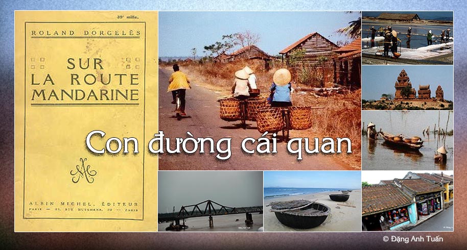
If a tourist has a chance to travel by car from Saigon to Hanoï, he has got to take the « mandarin route » (or route No.1 ) as it is the only one that exists on the road network in Vietnam. We owe the name of « mandarin route » to the French who named it in 19th century because it is certain that it was the road taken by mandarins and high functionaries to travel rapidly and easily between the capital and their provinces. This route is born in the swamps of  Mekong delta infested with mosquitoes. It begins at Cà Mau and ends at the post of Ðồng Ðằng on the Sino-Vietnamese border in the region close to Lạng Sơn. It is often said that this route is the country’s backbone that looks like a sea horse. This route is 1730km long, linking several cities, in particular Saigòn, Phan Thiết, Nha Trang, Qui Nhơn, Hội An, Ðà Nẵng, Huế, Ðồng Hới, Hà Tịnh, Thanh Hóa and Hanoï.

It is generally covered with asphalt, but often on some sections, it was badly paved and weighed down by a multitude of trucks, bicycles, pedestrians, buffaloes, cows, and troops of ducks walking on. The bitumen often breaks, causing the grandmother perching side-saddle on the baggage carrier and girls leaning on too big bikes, to jump. Those are the familiar scenes often encountered on this road.

One also finds harvested rice and manioc left to dry on asphalt heated by the sun in the North. On this route, one can see on a side of Sa Huynh, the salt fields or mounds of salt recovered from the foliage and set up alongside of the road. The further one goes north, the more one sees peaceful landscapes of flooded rice paddies.

One often crosses children leading herds of buffaloes daubed with mud. At the edge of Hoa Lư, the ancient capital of Viet Nam, silhouettes of rocky hills emerge from the bluish mist.

Despite its bad condition especially in North Vietnam, it continues to be the axle road vital to Vietnam. For those who like to know the history of Vietnam, the history of the long march towards the South, it is suggested that this route be borrowed because one would find not only the vestiges of a lost civilization in the whirlwind of history, the kingdom of Champa, but also the marks and traces that Vietnamese settlers, for the past decades, succeeded in carving during their passage.

Pictures gallery

Quốc lộ số 1

To know this route is to know not only the immense rice paddies, rubber tree plantations, beautiful sightseeing points on the coast of Vietnam, very beautiful panoramic views from one delta to another, superbs passes (in particular the Hải Vân pass) and wooded hills, almost desolate waste lands, but also an intensity of a Vietnamese agricultural life through hamlets located alongside of the route.

To know this route is to also know the Hiền Lương bridge. It was built by the French in 1950, destroyed by an American airplane in 1967, 178 meters long. It certainly evokes an episode when Viet Nam was divided and when one-half of the bridge was painted red and the other half yellow. It is located at the 17th parallel, in a zone where one of its sections, known during the Indochina war as « the Road without Joy » as French troops encountered fierce resistence there.

To know this route is to know the Hải Vân pass. It is located at 28km north of Ðà Nẫng ( or Tourane ) and only 495m high. As its name indicates, it is always in the clouds because it is close to the sea, which allows it to receive important masses of humid air. In the old days, it marked the frontier between the North and the South and protected the Chams from the Vietnamese appetite for land.

Composer Phạm Duy has evoked this route through his work entitled « Con Ðường Cái Quan« .


Route mandarine (Version française)

English version


Version française

Con đường cái Quan

Nếu du khách có cơ hội đi từ Sài Gòn đến Hà Nội bằng ô tô thì bắt buộc phải đi « con đường cái quan » (hoặc Quốc Lộ số 1) vì đây là tuyến đường duy nhất ở Việt Nam. Tên này có tên là « con đường của các quan » mà người Pháp gọi nó như vậy  bởi vì đây là tuyến đường trước đó được các quan lại và các quan chức cao cấp dùng để đi nhanh chóng dễ dàng giữa thủ đô và các tỉnh. Con đường này được sinh ra ở vùng đầm lầy của đồng bằng sông Cửu Long, đầy dãy các muỗi truyền nhiễm. Nó được bắt đầu ở  Cà Mau và kết thúc tại đồn Đồng Đăng ở biên giới Trung-Việt gần vùng Lạng Sơn. Nó thường được xem là cột sống của đất nước trông nhìn như hồi hải mã (cá ngựa). Con đường này dài đến 1.730 cây số, nối liền một số thành phố, đặc biệt là Cà Mau, Bạc Liêu, Cần Thơ, Vĩnh Long, Sài Gòn (hay thành phố Hồ Chí Minh), Phan Thiết, Nha Trang, Quy Nhơn, Hội An, Đà Nẵng, Huế, Đồng Hới, Hà Tĩnh, Thanh Hóa, Ninh Bình, Hà Nội, Lạng Sơn.

Con đường nầy thường được trán nhựa nhưng trải nhựa rất kém thường bị tắc nghẽn trên vài đoạn đường với một số xe vận tải, xe đạp, các người đi bộ,  các đàn trâu, bò và các đàn vịt chạy lon ton. Nhựa đường hay thường bị nổ vỡ, làm cho bà cụ giật mình gác hai chân trên giá hành lý và những đứa trẻ ngồi trên những chiếc xe đạp quá lớn. Đây là những cảnh tượng bất thường hay gặp trên tuyến đường này.

Ngoài ra còn có những mớ lúa hoặc sắn thu thập còn đang phơi khô trên các đường nhựa nung dưới ánh mặt trời ở miền Bắc. Trên con đường này, chúng ta  có thể nhìn thấy ở phía Sa Huỳnh, các đầm lầy muối hoặc những ụ muối phủ đầy một lớp lá và  được dựng theo dọc đường. Càng đi xa về phía bắc, chúng ta càng có được những quan cảnh  yên bình của những cánh đồng lúa ngập nước. Chúng ta thường bắt gặp những đứa trẻ dẫn đầu đàn trâu dính bùn. Ở ngoại ô Hoa Lư, cố đô của Việt Nam, các hình bóng của những ngọn đồi núi đá vôi xuất hiện trong sương mù.Mặc dù tình trạng đường xá rất tồi tệ nhất là ở miền Bắc Việt Nam, nó vẫn tiếp tục là trục đường quan trọng của Việt Nam. Đối với những người thích tìm hiểu về lịch sử Việt Nam, lịch sữ của cuộc Nam tiến, chúng ta  cần nên đi theo con đường này bởi vì chúng ta không chỉ thấy  các di tích của một nền văn minh bị biến mất trong cơn lốc lịch sử, vương quốc Champa mà  còn cả dấu ấn và dấu vết của  những người định cư Việt Nam qua nhiều thập kỷ mà họ  cố gắng áp đặt trong suốt thời gian họ đi qua. Biết con đường này là không chỉ biết đến những cánh đồng lúa mênh mông, những đồn điền cao su, những góc nhìn tuyệt đẹp dọc theo bờ biển Việt Nam, những toàn cảnh tuyệt vời từ đồng bằng này sang đồng bằng khác, các đèo vô cùng ngoạn mục  đặc biệt là đèo Hải Vân, những ngọn đồi rừng rậm, những cánh đồng gần như hoang vắng nhưng cũng có  một sức mạnh của đời sống nông nghiệp Việt Nam thông qua các ấp dọc theo con đường. Biết con đường này là cũng biết đến cầu Hiền Lương. Cầu này do người Pháp xây dựng vào năm 1950, bị không quân Mỹ phá hủy năm 1967, dài được 178m, chắc chắn gợi lại một thời mà đất nước còn bị chia đôi với một nửa cầu được sơn màu đỏ và nửa còn lại màu vàng. Nó nằm ở trên vĩ tuyến 17, trong một khu vực có một đoạn đường  được biết đến trong thời kỳ chiến tranh Đông Dương dưới cái tên « Đường không vui » vì quân đội Pháp gặp sự kháng cự quyết liệt ở nơi nầy. Biết tuyến đường này là biết đèo Hải Vân. Nó nằm 28  cây số về phía bắc của Đà Nẵng (hoặc Tourane) và chỉ có 496 thước so với mực nước biển. Cũng như tên gọi của nó, nó luôn ở trong mây vì nó rất gần biển, khiến nó  lúc nào cũng nhận được một khối lượng lớn không khí ẩm thấp. Thưở xưa, nó đánh dấu biên giới giữa Bắc và Nam mà còn bảo vệ người Chămpa trước dục vọng xâm chiếm lãnh thổ của người dân Việt. Cố nhạc sỹ Phạm Duy có gợi  đến con đường này qua tác phẩm được mang tên « Con Đường Cái Quan ». 

Route mandarine

Si le touriste a l’occasion de voyager de Saïgon à Hanoï en voiture, il est obligé de prendre la « route mandarine » (ou la route No 1) car c’est la seule qui existe sur le réseau routier du Vietnam. Ce nom « route mandarine », on le doit aux Français qui l’ont appelé car c’était la route prise autrefois par les mandarins et les hauts fonctionnaires pour voyager rapidement et aisément entre la capitale et leurs provinces. Cette route est née dans les marécages du delta du Mékong,  infestés de moustiques. Elle commence à Cà Mau et se termine au poste de Ðồng Ðan de la frontière sino-viêtnamienne dans la région proche de Lạng Sơn.  On dit souvent qu’elle est la colonne vertébrale du pays au « look » d’hippocampe. Cette route est longue de 1730 km, reliant plusieurs villes, en particulier Saïgon, Phan Thiết, Nha Trang, Qui Nhơn, Hội An, Ðà Nẵng, Huế, Ðồng Hới, Hà Tịnh, Thanh Hóa et Hanoï.

Elle est recouverte d’une manière générale d’asphalte, mais mal bitumée et encombrée souvent sur certains tronçons d’une multitude de camions, de vélos, de piétons, de buffles et de vaches et de troupeaux de canards qui trottinent. Le bitume explose souvent, faisant tressauter la mamie grimpée en amazone sur un porte-bagages et les mômes juchés sur des vélos trop grands. Ce sont des scènes insolites rencontrées fréquemment sur cette route.

On trouve aussi des récoltes de riz ou de manioc mises à sécher sur l’asphalte chauffée de soleil dans le Nord. Sur cette route, on peut voir du côté de Sa Huynh, des marais salants ou des monticules de sel recouverts de feuillage et dressés le long de la chaussée.

Plus on s’avance dans le Nord, plus on rencontre des paysages paisibles de rizières inondées. On croise souvent des enfants menant des troupeaux de buffles laqués de boue. Aux abords de Hoa Lư, l’ancienne capitale du Vietnam, les silhouettes des collines rocheuses émergent d’une brume bleutée.

Malgré son mauvais état surtout dans le Nord du Vietnam, elle continue à être l’axe routier vital du Vietnam. Pour ceux qui aiment connaître l’histoire du Vietnam, l’histoire de sa longue marche vers le Sud, il est conseillé d’emprunter cette route car on retrouve non seulement les vestiges d’une civilisation disparue dans le tourbillon de l’histoire, le royaume du Champa mais aussi les marques et les traces que les colons vietnamiens, depuis des décennies, arrivèrent à imposer lors de leur passage.

Galerie des photos

Connaître cette route c’est connaître non seulement des rizières immenses, des plantations d’hévéas, de beaux points de vue sur la côte du Vietnam, de très beaux panoramas d’un delta à un autre, de cols superbes (en particulier le col des Nuages ) et de collines boisées, des landes presque désolées mais aussi une intensité de vie agricole vietnamienne à travers les hameaux qui longent la route.

Connaître cette route c’est connaître aussi le pont Hiền Lương. Celui-ci construit par les Français en 1950, détruit par l’aviation américaine en 1967, long de 178m, évoque certainement une époque où le Vietnam était divisé et où la moitié du pont était peinte en rouge et l’autre moitié en jaune. Il est situé au 17ème parallèle, dans une zone où est situé un tronçon, connu lors de la guerre d’Indochine sous le nom « Rue sans Joie » car les troupes françaises y rencontrèrent de farouches résistances.       

Quốc lộ số 1

Connaître cette route c’est connaître le col des Nuages. Celui-ci est situé à 28 km au Nord de Ðà Nang (ou Tourane) et seulement 496 m d’altitude. Comme son nom l’indique, il est toujours dans les nuages car il est proche de la mer, ce qui lui permet de recevoir d’importantes masses d’air humide. Autrefois, il marquait la frontière entre le Nord et le Sud et protégeait les Chams des appétits territoriaux vietnamiens.

Le compositeur Phạm Duy a évoqué cette route à travers son oeuvre intitulé Con Ðường Cái Quan.

Rédigé en 1998
Red river delta (Đồng bằng sông Hồng)

French version

delta_rouge


Contrary to the Mekong Delta, the Red River Delta contains many historical vestiges. It is the cradle of the Vietnamese nation. Found here, near Thanh Hoá in the Mã River valley is the presence of an civilization in the millenium before Christ at the Bronze Age called Dongsonian Age. Also started with the Bronze Age, the mystical periods of Vietnam’s history. The first legendary dynasty, that of Hồng Bàng, would have reigned until 3rd century B.C. From this delta has begun at the beginning of10th century the Nam Tiến Movement (or the Descent toward the South) started by General Lê Hoàn and finished in 18th century by the kings Nguyễn.

To dominate and control its water and its vagaries, the Vietnamese people had to build and consolidate dikes ceaselessly. These dikes existed for a thousand years and broke sixteen times during the past twenty-five years. It is because of the Red river that the Vietnamese people has been haunted with the domination and control of water. Since the beginning of our era, the Vietnamese people have been compelled to organize, perform, and maintain water amnagement works. This has brought to the Vietnamese the virtue of being more patient, more obstinate, keener, hard working and methodical in dike construction, canal digging, embankment building and breach filling. In this delta is found a sophisticated network of drainage canals and high dikes that only a centralized state on water control such as Vietnam knows how to realize.

It is itself that witnessed several decisive battles of the Vietnamese people against their invaders. It is thanks to its complicity that General Trần Hưng Ðạo defeated the Mongol army by planting on its bed pikes that broke the Mongol ships in 1288 at the mouth of the Bạch Ðằng river, renewing the tactics used by General Ngô Quyền against the Chinese in 938 (a victory that put an end to the thousand-year Chinese domination ). It is also witness of the Yên Bái uprising led by nationalist leader Nguyễn Thái Học in 1930. Its destiny is that of the Vietnamese people. It is it that gives the capital of Vietnam the last name Hànội (Hà means river, Nội means inside, interior).

Hà-Nội means « On this side of the river ». This city was founded by king Lý Thái Tổ (Lý Công Uẩn) in year 1010 at the neighborhood of Ðại La that geomancers believed to be favorably sheltered from the waters of the Red river. It is also called Thăng Long (City of Ascending Dragon) because, in his dream, Lý Thái Tổ saw a golden dragon flying from that locality.

Pictures gallery


Vietnam’s history is linked closely with this Red River (or Sông Hồng ). It is itself that forged the Viet soul. It is itself that has petrified the thick identity of the Vietnamese people. At the same time, It is the enemy, the friend and the actor of the Vietnamese people.

It is it that saw Hanoï  growing with its thirty-six business streets and lakes. Writer Thạch Lam of the « Tự Lực Văn Ðoàn » writing club talked about It in his novel « Hà Nội 36 phố phường« . It is it that gave birth to the French construction of the Paul Doumer (now Cầu Long Biên) bridge 1680 meters (approx. one mile ) long at Hà Nôi.

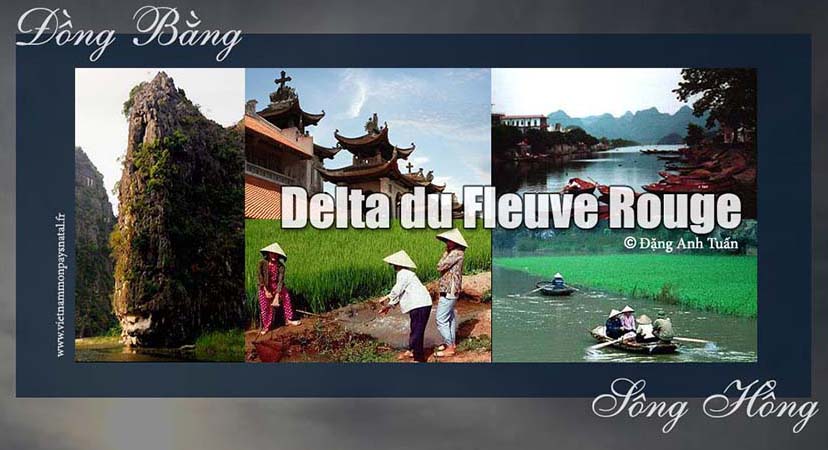
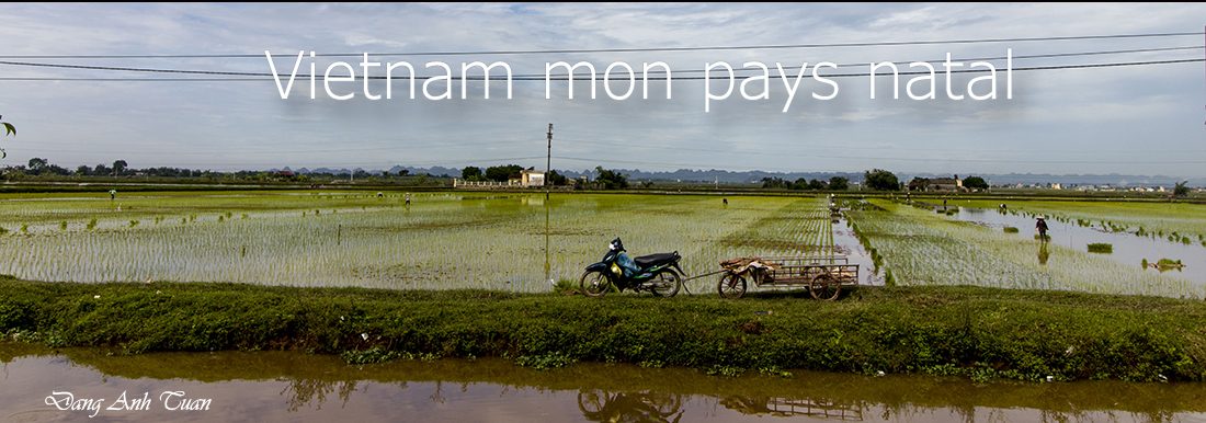
Thanks to its silt rich in iron, and with its irrigation, the delta is so fertile that it is possible to have one more harvest in November. It is it that shapes the landscape of the delta. Every day are seen women leaning under their conical hats, feet and hands in the clay, children coming from school surveying the dikes, motionless buffaloes in their mud baths under a sun that is sometimes overwhelming. It is it that often floods the plain of Hoa Lư, the old capital of Vietnam until 11th century.

The Red River is the second largest river of Vietnam after Mekong. It descends from Yunnan, a mountainous region south of China. It is known as the « six-head river » that enters Vietnam definitively at Lao Cai. It curves on more than 1000km ( over 600 miles ) before dying in the somptuous bay of Hạ Long. This one is the eighth wonder of the world. It counts more than three thousand isles, islets, and reefs. One finds rocks of varied forms. Some are tiny, others are of important dimmension bearing picturesque names such as isle of the Wonder, isle of the Surprise, the Marionettes, the Monkeys, the Toad etc…

The Ha Long bay has become for the past few years the site most visited by foreign tourists when they landed in Vietnam. Mini-cruises by junk make it possible to visit it. It is in this bay, according to the legend, that a dragon would have descended to tame the sea currents. That is why the Vietnamese called it Hạ Long (or the site of the Descending Dragon).

Impressed by the splendor and beauty of this bay that he visited by junk in 1468, king Lê Thánh Tôn left some unforgettable verses in witness of his emotion:

Muôn ngọn núi nổi trên như biển ngọc
La liệt như những sao sa, những quần cờ, chênh vênh màu xanh biếc …

High summits are drawn up as a crowd in the sea like many jewels
Bluish tops are dispersed like the falling stars and the pieces in the chessboard of waves.
Fish and salt, abundant like sand, offer a rapid gain to people

Dalat (English version)

Version française

  Thành phố sương mù

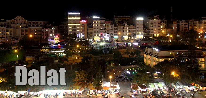
Located on the Vietnam’s Central Highlands, about 250 kilometers from Saigon and  1500 meters above sea level, Dalat continues to keep the charm of the 1920s.

In 1893, the discoverer of the plague bacillus and the Pasteur’s disciple, Alexandre Yersin has founded at the Lang Bian mountain plateau  a fertile ground for the establishment of a sanatorium. His project was followed several years later by that of Governor Paul Doumer in transforming Dalat into  the  most select climate  resort of South East Asia.
Here is found the little Paris of the Viet Nam with its buildings erected during the colonial era:  high school Yersin, convent of the sisters named “Couvent des Oiseaux”, private villas whose style is borrowed from Basque country, as well as from to  Savoy and Normandy.

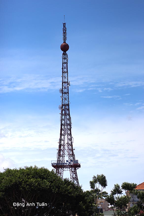
The railway station of Đà Lạt is a replica of the Deauville train station in miniature. Even the small red and white iron lady, the small Eiffel Tower is there to remind its Parisian colleague.

 Little Paris in Vietnam

Pictures gallery 

Thanks to the temperate climate (10 degrees in  winter) and 25 degrees in  summer, one can cultivate here  all citrus fruits and vegetables. That allows Dalat to become the  leading vegetable provider of the country. Flowers greenhouses are also in the honour  for the region. Known as  « the city of eternal spring », Dalat is characterized by a large number of « no »: no air conditioning, no traffic lights, no cycle ricksaws, no cops in  the streets, no supermarkets, no motorcycle taxis (xe ôm) etc..

Capital Hanoï (Vietnam)

Version française

Thăng Long muôn thưở 

As indicated by its name Hà Nội means « The city on this side of the river » (Hà means river, Nội means inside). Contrary to other cities in Vietnam, Hanoï has a long agitated history. Its destiny is that of the Vietnamese people. It experienced a long period of disgrace when Nguyễn Ánh arrived at founding the Nguyen dynasty in 1802 after 20 years of fighting the Tây Sơn and decided to transfer the capital to Huế (or Phú Xuân). It witnessed several decisive battles in the reclaim of independence, in particular the Đống Đa battle run by Emperor Quang Trung in 1789. Thanks to the blitzkrieg upon Chinese troops of Qing, and to Quang Trung’s scheme to choose the date of the Vietnamese new year to surprise the Chinese enemy, Hanoï was thus liberated as well as Vietnam. It was also chosen by Hồ Chí Minh to proclaim Vietnam’s independence on September 2, 1945 at Ba Đình Square.

It was also on one of its lakes under the name of Hồ Gươm where Lê Lợi, future king Lê Thái Tổ, after his victory over the Ming, according to a Vietnamese legend, returned his magic sword to a golden tortoise which gave him this sword during a walk. Thanks to this sword, Lê Lợi succeeded in chasing Chinese troops of Ming out of Viet Nam after 10 years of fighting a guerilla warfare. That is why the lake is known as « Lake of Returned Sword » (or Hồ Hoàn Kiếm).

It was also at Hanoï that the unique one-pillar pagoda (Chùa Một Cột) was erected in 1049 by king Lý Thái Tông on a strong wooden pillar in the style of ancient temples of ancestors. According to legend, the king afflicted by not having a descendant, saw in his dream Quan Âm, the Goddess of Compassion. Sitting on a lotus flower, she gave him a son. Shortly after that, a young country girl that he made favorite, gave him an heir. In witness of his gratitude, he had this pagoda erected in the middle of a pond of lotus flowers.

Because of its proximity to the Red river, every year Hà Nội is victim of floodings caused by the cresting of this river and by violent monsoon rain and typhoons.

In spite of that, Hà Nội continues to remain the capital of a unified Vietnam. No one dares to contest the political and cultural heritage it has left to the Vietnamese people. It represents not only for the majority of Vietnamese the symbol of national unity but also the pride of a people of peasants who know how to valiantly resist the changes of nature and the ambitions of invaders.

Hànội vắng những cơn mưa

Saxophoniste Quyền Văn Minh

Pictures gallery


Thăng Long muôn thưở

Before becoming the capital city of Việt-Nam, Hà Nội was the seat of the Chinese administration in 607 and bore the name of « Tống Bình« . In 866, this seat was surrounded by the wall of Ðại La whose some vestiges still exist. It was chosen by the founder of the Lý dynasty, king Lý’ Công Uẩn, in 1010 as a new capital of Vietnam at the place of Hoa Lư.

According to legend, in his dream the king saw a golden dragon flying over that locality. That is why Hà Nội was called at that time « Thăng Long » (ascending dragon)« .

This site was deemed favorable in comparison with other sites because it is located between « hà » and « sơn », waters and mountains, in the middle of rice paddies and protected from flooding by dikes. In 15th century, Hà Nội took the name of Ðông Kinh. Then it retook the name of Thăng Long until the transfer of the royal residence to Huế. Next, it took the name of Thành Tích then Bắc Thành before becoming Hà Nội only in 1931. It became the capital of North Viet-Nam after the Geneva Accord in 1954 and since the events of 1975, the capital of reunified Viet-Nam.

Hà Nội covers 913km2. Its interior (or nội thành 40km2) is divided into four urban districts (or Quận): Quận Hoàn Kiếm, Quận Hai Bà Trưng, Quận Ðống Ða, and Quận Ba Ðình. It also includes six suburban districts (or Huyện) and several villages located within its limits.

One finds the soul of Hà Nội through its old city. Poetess Bà Huyện Thanh Quan, a poetess of 19th century evoked it in one of her works.
What retains the most in that old city are the 36 streets that are often known as Hàng (or merchendise in English). There, each cratfsman makes his specialty object and each street was baptized following the craft that was practiced there: street of Silk, street of Drums, street of Potteries etc… Novelist Thạch Lam talked about it in his novel « Hà Nội, 36 Phố Phường« . Hà Nội is also the Vietnamese city which keeps more colonial traits compared to other cities. It can be said that it is the conformed copy of a French town in the structure of Arcachon, with its governor’s palace, opera house, post office and park. The bridge Long Biên (or Paul Doumer) recalls not only the first work of art of French builders on the Red river in 1902 but also the traces of American bombings during the Vietnam War.

In spite of that, Hanoï, from the past few years begins to change its face and look. Constructions have been multiplied at such a rhythm that there is not one square meter unoccupied. It tries to catch up with its late economy and to fill in the incoming vacuum left by the return of Hong Kong to China.